Area Overview for SP6 2RD
Photos of SP6 2RD
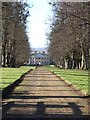
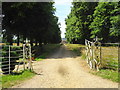
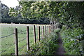
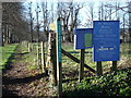
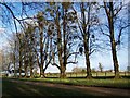
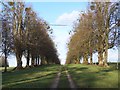
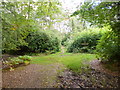
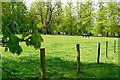
19 photos from this area
Area Information
Key information about the SP6 2RD including its size, population, and administrative classification.
- Area Type
- Postcode
- Area Size
- 28.0 hectares
- Population
- 1337
- Population Density
- 52 people/km²
House Prices in SP6 2RD
8
Properties
£1,697,167
Average Sold Price
£485,000
Lowest Price
£5,445,000
Highest Price
Showing 8 properties
| Address | Type | Beds | Baths | Last Sale Price | Last Sale Date | |
|---|---|---|---|---|---|---|
| Hale Farm, Hale Farm House, Queen Street, Hale, SP6 2RD | Detached | 8 | 5 | £2,300,000 | Mar 2025 | |
| Spring Cottage, Queen Street, Hale, SP6 2RD | Semi-detached | 3 | 2 | £640,000 | Oct 2024 | |
| Hemmick Court, Queen Street, Hale, SP6 2RD | house | 9 | - | £5,445,000 | May 2021 | |
| 3 Queen Street, Hale, SP6 2RD | house | - | - | £485,000 | Mar 2016 | |
| The Garden Cottage, Queen Street, Hale, SP6 2RD | Detached | 7 | - | £663,000 | Aug 2005 | |
| The Old Rectory, Queen Street, Hale, SP6 2RD | house | - | - | £650,000 | Dec 2000 | |
| Tennis 61M From Copse Cottage, Queen Street 45M From Queen Street, Queen Street, Hale, SP6 2RD | Leisure | - | - | - | - | |
| Copse Cottage, Queen Street, Hale, SP6 2RD | Detached | - | - | - | - |
Energy Efficiency in SP6 2RD
Amenities
Schools
| Rank | School | Type | Entry gender | Ages |
|---|
Explore more schools in this area
Go to Schools tabDemographics
Household Size
Two person
most common
Accommodation Type
Houses
most common
Tenure
70
majority
Ethnic Group
White
most common
Religion
N/A
most common
Household Composition
N/A
most common
Age
47
median
Adults (30-64 years)
most common
Household Deprivation
N/A
with no deprivation
NS-SEC
44
in Lower managerial occupations
Explore more demographic insights in this area
Go to Demographics tabPlanning
Planning Constraints
- Flood RiskPremium
- Ramsar Wetland SitesPremium
- Area of Outstanding Natural BeautyPremium
- Protected Nature ReservePremium
- Protected WoodlandPremium