Area Overview for SP6 2EX
Photos of SP6 2EX
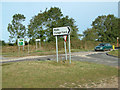
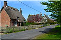
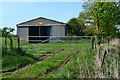
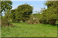
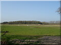
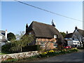
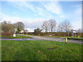
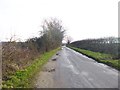
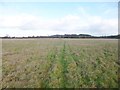
18 photos from this area
Area Information
Key information about the SP6 2EX including its size, population, and administrative classification.
- Area Type
- Postcode
- Area Size
- 32.1 hectares
- Population
- 1305
- Population Density
- 38 people/km²
House Prices in SP6 2EX
9
Properties
£115,000
Average Sold Price
£115,000
Lowest Price
£115,000
Highest Price
Showing 9 properties
| Address | Type | Beds | Baths | Last Sale Price | Last Sale Date | |
|---|---|---|---|---|---|---|
| Anfield House, Ringwood Road, Fordingbridge, SP6 2EX | house | - | - | £115,000 | Sep 1998 | |
| Open Country Craft And Gift Shop, Ringwood Road, Fordingbridge, SP6 2EX | Flat | - | - | - | - | |
| Gorley Nurseries, Ringwood Road, Fordingbridge, SP6 2EX | Farm | - | - | - | - | |
| Caravan Rear Of The Bungalow, Gorley Nurseries, Ringwood Road, Fordingbridge, SP6 2EX | office_workshop | - | - | - | - | |
| Chalkies Pub And Cafe, Ringwood Road, Fordingbridge, SP6 2EX | Retail | - | - | - | - | |
| Car Angels, Ringwood Road, Fordingbridge, SP6 2EX | shop | - | - | - | - | |
| Bungalow, Gorley Nurseries, Ringwood Road, Fordingbridge, SP6 2EX | Detached | - | - | - | - | |
| Annexe At The Bungalow, Gorley Nurseries, Ringwood Road, Fordingbridge, SP6 2EX | Flat | - | - | - | - | |
| Whites Motors, Ringwood Road, Fordingbridge, SP6 2EX | Industrial | - | - | - | - |
Energy Efficiency in SP6 2EX
Amenities
Schools
| Rank | School | Type | Entry gender | Ages |
|---|
Explore more schools in this area
Go to Schools tabDemographics
Household Size
Two person
most common
Accommodation Type
Houses
most common
Tenure
89
majority
Ethnic Group
White
most common
Religion
N/A
most common
Household Composition
N/A
most common
Age
47
median
Adults (30-64 years)
most common
Household Deprivation
N/A
with no deprivation
NS-SEC
44
in Lower managerial occupations
Explore more demographic insights in this area
Go to Demographics tabPlanning
Planning Constraints
- Flood RiskPremium
- Ramsar Wetland SitesPremium
- Area of Outstanding Natural BeautyPremium
- Protected Nature ReservePremium
- Protected WoodlandPremium