Area Overview for SP6 2EA
Photos of SP6 2EA


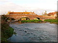

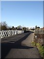

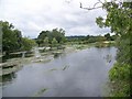
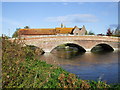


67 photos from this area
Area Information
Key information about the SP6 2EA including its size, population, and administrative classification.
- Area Type
- Postcode
- Area Size
- 15.3 hectares
- Population
- 1337
- Population Density
- 52 people/km²
House Prices in SP6 2EA
14
Properties
£369,143
Average Sold Price
£129,500
Lowest Price
£650,000
Highest Price
Showing 14 properties
| Address | Type | Beds | Baths | Last Sale Price | Last Sale Date | |
|---|---|---|---|---|---|---|
| The Long House, Salisbury Road, Breamore, SP6 2EA | house | - | - | £650,000 | Jun 2021 | |
| Merryfields, Salisbury Road, Breamore, SP6 2EA | house | 4 | - | £585,000 | Dec 2017 | |
| The Post House, Salisbury Road, Breamore, SP6 2EA | house | - | - | £579,500 | Jul 2013 | |
| Hawthorne Cottage, Salisbury Road, Breamore, SP6 2EA | Semi-detached | - | - | £285,000 | Jul 2003 | |
| Priory View, Salisbury Road, Breamore, SP6 2EA | Semi-detached | 3 | 2 | £175,000 | Jun 2002 | |
| Kilford House, Salisbury Road, Breamore, SP6 2EA | Detached | - | - | £180,000 | Jun 2002 | |
| The Chestnuts, Salisbury Road, Breamore, SP6 2EA | Semi-detached | - | - | £129,500 | Jun 1999 | |
| Clements Cottage, Salisbury Road, Breamore, SP6 2EA | Semi-detached | 1 | 1 | - | - | |
| Old Forge, Salisbury Road, Breamore, SP6 2EA | Cottage | 2 | 1 | - | - | |
| Wheelwrights Cottage, Salisbury Road, Breamore, SP6 2EA | Detached | 4 | - | - | - |
Page 1 of 2
Energy Efficiency in SP6 2EA
Amenities
Schools
| Rank | School | Type | Entry gender | Ages |
|---|
Explore more schools in this area
Go to Schools tabDemographics
Household Size
Two person
most common
Accommodation Type
Houses
most common
Tenure
70
majority
Ethnic Group
White
most common
Religion
N/A
most common
Household Composition
N/A
most common
Age
47
median
Adults (30-64 years)
most common
Household Deprivation
N/A
with no deprivation
NS-SEC
44
in Lower managerial occupations
Explore more demographic insights in this area
Go to Demographics tabPlanning
Planning Constraints
- Flood RiskPremium
- Ramsar Wetland SitesPremium
- Area of Outstanding Natural BeautyPremium
- Protected Nature ReservePremium
- Protected WoodlandPremium