Area Overview for SP6 2BT
Photos of SP6 2BT
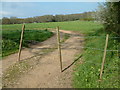
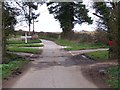
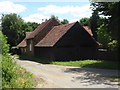
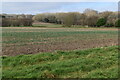
21 photos from this area
Area Information
Key information about the SP6 2BT including its size, population, and administrative classification.
- Area Type
- Postcode
- Area Size
- 1.1 km²
- Population
- 1337
- Population Density
- 52 people/km²
House Prices in SP6 2BT
8
Properties
£598,333
Average Sold Price
£350,000
Lowest Price
£745,000
Highest Price
Showing 8 properties
| Address | Type | Beds | Baths | Last Sale Price | Last Sale Date | |
|---|---|---|---|---|---|---|
| Rose Cottage, Outwick, Breamore, SP6 2BT | Detached | - | - | £745,000 | Nov 2021 | |
| Outwick Farm, Outwick, Breamore, SP6 2BT | Detached | - | - | £700,000 | Feb 2018 | |
| Brick Kiln Cottage, Outwick, Breamore, SP6 2BT | Detached | - | - | £350,000 | May 1999 | |
| The Manor House, Outwick, Breamore, SP6 2BT | house | - | - | - | - | |
| 1, Outwick Cottages, Upper Street, Breamore, SP6 2BT | house | - | - | - | - | |
| High Hall, Outwick, Breamore, SP6 2BT | house | - | - | - | - | |
| 2, Outwick Cottages, Upper Street, Breamore, SP6 2BT | house | - | - | - | - | |
| Annexe, High Hall, Outwick, Breamore, SP6 2BT | Flat | - | - | - | - |
Energy Efficiency in SP6 2BT
Amenities
Schools
| Rank | School | Type | Entry gender | Ages |
|---|
Explore more schools in this area
Go to Schools tabDemographics
Household Size
Two person
most common
Accommodation Type
Houses
most common
Tenure
70
majority
Ethnic Group
White
most common
Religion
N/A
most common
Household Composition
N/A
most common
Age
47
median
Adults (30-64 years)
most common
Household Deprivation
N/A
with no deprivation
NS-SEC
44
in Lower managerial occupations
Explore more demographic insights in this area
Go to Demographics tabPlanning
Planning Constraints
- Flood RiskPremium
- Ramsar Wetland SitesPremium
- Protected Nature ReservePremium
- Protected WoodlandPremium