Area Overview for SP11 8NF
Photos of SP11 8NF
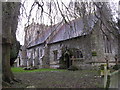
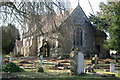
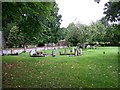


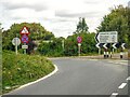
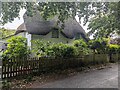

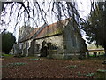
36 photos from this area
Area Information
Key information about the SP11 8NF including its size, population, and administrative classification.
- Area Type
- Postcode
- Area Size
- 31.1 hectares
- Population
- 1440
- Population Density
- 63 people/km²
House Prices in SP11 8NF
30
Properties
£379,750
Average Sold Price
£168,000
Lowest Price
£670,000
Highest Price
Showing 30 properties
| Address | Type | Beds | Baths | Last Sale Price | Last Sale Date | |
|---|---|---|---|---|---|---|
| The Old Forge, Village Street, Thruxton, SP11 8NF | Detached | 4 | 2 | £625,000 | May 2024 | |
| The Covey, Village Street, Thruxton, SP11 8NF | Retail | 4 | 3 | £485,000 | Nov 2022 | |
| Hawthorn Cottage, Village Street, Thruxton, SP11 8NF | Detached | - | - | £402,000 | Sep 2021 | |
| April Cottage, Village Street, Thruxton, SP11 8NF | Detached | 3 | 1 | £357,000 | May 2021 | |
| Pastoral, Village Street, Thruxton, SP11 8NF | Detached | 5 | 3 | £460,000 | Mar 2021 | |
| Curlew Cottage, Village Street, Thruxton, SP11 8NF | Cottage | 2 | 1 | £340,000 | Sep 2019 | |
| Gracelands, Village Street, Thruxton, SP11 8NF | Bungalow | 3 | 2 | £420,000 | Jul 2018 | |
| Ashwell Cottage, Village Street, Thruxton, SP11 8NF | Cottage | 2 | 1 | £270,000 | May 2018 | |
| Tarvers, Village Street, Thruxton, SP11 8NF | Detached | 4 | 1 | £421,500 | May 2018 | |
| Beech House, Village Street, Thruxton, SP11 8NF | house | 2 | 2 | £347,000 | Nov 2015 |
Page 1 of 3
Energy Efficiency in SP11 8NF
Amenities
Schools
| Rank | School | Type | Entry gender | Ages |
|---|
Explore more schools in this area
Go to Schools tabDemographics
Household Size
Two person
most common
Accommodation Type
Houses
most common
Tenure
74
majority
Ethnic Group
White
most common
Religion
N/A
most common
Household Composition
N/A
most common
Age
47
median
Adults (30-64 years)
most common
Household Deprivation
N/A
with no deprivation
NS-SEC
43
in Lower managerial occupations
Explore more demographic insights in this area
Go to Demographics tabPlanning
Planning Constraints
- Flood RiskPremium
- Ramsar Wetland SitesPremium
- Area of Outstanding Natural BeautyPremium
- Protected Nature ReservePremium
- Protected WoodlandPremium