Area Overview for SP11 8JB
Photos of SP11 8JB


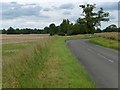
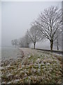
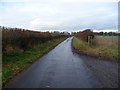
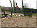
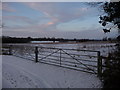
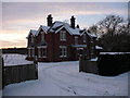
28 photos from this area
Area Information
Key information about the SP11 8JB including its size, population, and administrative classification.
- Area Type
- Postcode
- Area Size
- 1.9 km²
- Population
- 2339
- Population Density
- 69 people/km²
House Prices in SP11 8JB
13
Properties
£645,882
Average Sold Price
£400,000
Lowest Price
£880,341
Highest Price
Showing 13 properties
| Address | Type | Beds | Baths | Last Sale Price | Last Sale Date | |
|---|---|---|---|---|---|---|
| The Old Farm House, Hay Down Lane, Fox Amport, SP11 8JB | house | - | - | £880,341 | Sep 2009 | |
| The Forge, Fox Farm, Amport, SP11 8JB | house | - | - | £870,000 | Feb 2009 | |
| Foxwood Lodge, Georgia Lane, Amport, SP11 8JB | Detached | 6 | 5 | £400,000 | Oct 2002 | |
| Stable Barn, Fox Farm, Amport, SP11 8JB | Semi-detached | - | - | £695,000 | Sep 2002 | |
| Flint Barn, Fox Farm, Amport, SP11 8JB | Detached | - | - | £499,950 | Feb 2002 | |
| Long Barn, Fox Farm, Amport, SP11 8JB | Detached | 5 | 4 | £530,000 | Dec 2001 | |
| Foxwell House, Georgia Lane, Amport, SP11 8JB | Detached | 4 | 2 | - | - | |
| Witcham, Georgia Lane, Amport, SP11 8JB | Detached | 4 | 2 | - | - | |
| Sarson Wood Cottage, Hay Down Lane, Fox Amport, SP11 8JB | undefined | - | - | - | - | |
| Tennis 64M From Witcham 68M From Georgia Lane, Georgia Lane, Amport, SP11 8JB | Leisure | - | - | - | - |
Page 1 of 2
Energy Efficiency in SP11 8JB
Amenities
Schools
| Rank | School | Type | Entry gender | Ages |
|---|
Explore more schools in this area
Go to Schools tabDemographics
Household Size
Two person
most common
Accommodation Type
Houses
most common
Tenure
75
majority
Ethnic Group
White
most common
Religion
N/A
most common
Household Composition
N/A
most common
Age
47
median
Adults (30-64 years)
most common
Household Deprivation
N/A
with no deprivation
NS-SEC
41
in Lower managerial occupations
Explore more demographic insights in this area
Go to Demographics tabPlanning
Planning Constraints
- Flood RiskPremium
- Ramsar Wetland SitesPremium
- Area of Outstanding Natural BeautyPremium
- Protected Nature ReservePremium
- Protected WoodlandPremium