Area Overview for SP11 8AB
Photos of SP11 8AB
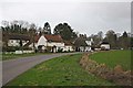
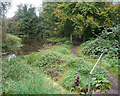
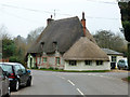
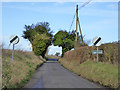
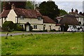
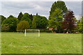
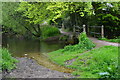
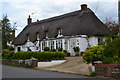
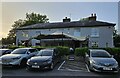
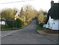
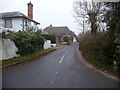
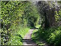
45 photos from this area
Area Information
Key information about the SP11 8AB including its size, population, and administrative classification.
- Area Type
- Postcode
- Area Size
- 16.0 hectares
- Population
- 2339
- Population Density
- 69 people/km²
House Prices in SP11 8AB
45
Properties
£261,707
Average Sold Price
£80,000
Lowest Price
£580,000
Highest Price
Showing 45 properties
| Address | Type | Beds | Baths | Last Sale Price | Last Sale Date | |
|---|---|---|---|---|---|---|
| 30 Sarson Close, Amport, SP11 8AB | Semi-detached | 3 | 1 | £360,000 | Dec 2024 | |
| 36 Sarson Close, Amport, SP11 8AB | Semi-detached | 3 | 1 | £580,000 | Dec 2023 | |
| Fieldview, 2C Sarson Close, Amport, SP11 8AB | house | 3 | 2 | £410,000 | Oct 2023 | |
| 7 Sarson Close, Amport, SP11 8AB | house | - | - | £385,000 | Sep 2021 | |
| 8 Sarson Close, Amport, SP11 8AB | Semi-detached | 3 | 1 | £289,950 | May 2014 | |
| 9 Sarson Close, Amport, SP11 8AB | house | - | - | £240,000 | Jun 2013 | |
| 27 Sarson Close, Amport, SP11 8AB | Semi-detached | - | - | £224,950 | Apr 2007 | |
| 29 Sarson Close, Amport, SP11 8AB | Semi-detached | - | - | £245,000 | Jan 2007 | |
| 16 Sarson Close, Amport, SP11 8AB | house | - | - | £175,000 | Apr 2005 | |
| 2A Sarson Close, Amport, SP11 8AB | Flat | - | - | £80,000 | Mar 2005 |
Page 1 of 5
Energy Efficiency in SP11 8AB
Amenities
Schools
| Rank | School | Type | Entry gender | Ages |
|---|
Explore more schools in this area
Go to Schools tabDemographics
Household Size
Two person
most common
Accommodation Type
Houses
most common
Tenure
75
majority
Ethnic Group
White
most common
Religion
N/A
most common
Household Composition
N/A
most common
Age
47
median
Adults (30-64 years)
most common
Household Deprivation
N/A
with no deprivation
NS-SEC
41
in Lower managerial occupations
Explore more demographic insights in this area
Go to Demographics tabPlanning
Planning Constraints
- Flood RiskPremium
- Ramsar Wetland SitesPremium
- Area of Outstanding Natural BeautyPremium
- Protected Nature ReservePremium
- Protected WoodlandPremium