Area Overview for SP11 7QA
Photos of SP11 7QA
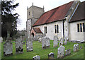
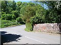
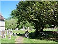
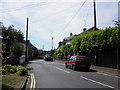
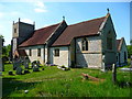
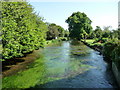
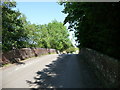
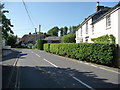
90 photos from this area
Area Information
Key information about the SP11 7QA including its size, population, and administrative classification.
- Area Type
- Postcode
- Area Size
- 9.8 hectares
- Population
- 1509
- Population Density
- 77 people/km²
House Prices in SP11 7QA
59
Properties
£234,469
Average Sold Price
£32,062
Lowest Price
£345,000
Highest Price
Showing 59 properties
| Address | Type | Beds | Baths | Last Sale Price | Last Sale Date | |
|---|---|---|---|---|---|---|
| 49 Above Town, Upper Clatford, SP11 7QA | Semi-detached | 3 | - | £345,000 | Jun 2025 | |
| 44 Above Town, Upper Clatford, SP11 7QA | Semi-detached | 3 | 1 | £325,000 | May 2023 | |
| 55 Above Town, Upper Clatford, SP11 7QA | Retail | 2 | 1 | £300,000 | Aug 2022 | |
| 54 Above Town, Upper Clatford, SP11 7QA | Semi-detached | 3 | 1 | £280,000 | Aug 2021 | |
| 19 Above Town, Upper Clatford, SP11 7QA | house | - | - | £280,000 | Aug 2021 | |
| 45 Above Town, Upper Clatford, SP11 7QA | Semi-detached | 3 | 1 | £270,000 | Mar 2021 | |
| 29 Above Town, Upper Clatford, SP11 7QA | house | - | - | £325,000 | Mar 2021 | |
| 67 Above Town, Upper Clatford, SP11 7QA | Bungalow | - | - | £190,000 | Dec 2017 | |
| 48 Above Town, Upper Clatford, SP11 7QA | house | - | - | £275,000 | Jun 2017 | |
| 43 Above Town, Upper Clatford, SP11 7QA | house | - | - | £243,000 | Jun 2006 |
Page 1 of 6
Energy Efficiency in SP11 7QA
Amenities
Schools
| Rank | School | Type | Entry gender | Ages |
|---|
Explore more schools in this area
Go to Schools tabDemographics
Household Size
Two person
most common
Accommodation Type
Houses
most common
Tenure
84
majority
Ethnic Group
White
most common
Religion
N/A
most common
Household Composition
N/A
most common
Age
47
median
Adults (30-64 years)
most common
Household Deprivation
N/A
with no deprivation
NS-SEC
52
in Lower managerial occupations
Explore more demographic insights in this area
Go to Demographics tabPlanning
Planning Constraints
- Flood RiskPremium
- Ramsar Wetland SitesPremium
- Area of Outstanding Natural BeautyPremium
- Protected Nature ReservePremium
- Protected WoodlandPremium