Area Overview for SP11 7ND
Photos of SP11 7ND
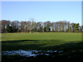


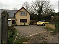

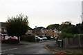


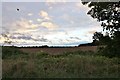

27 photos from this area
Area Information
Key information about the SP11 7ND including its size, population, and administrative classification.
- Area Type
- Postcode
- Area Size
- 12.1 hectares
- Population
- 1483
- Population Density
- 153 people/km²
House Prices in SP11 7ND
18
Properties
£366,944
Average Sold Price
£92,000
Lowest Price
£695,000
Highest Price
Showing 18 properties
| Address | Type | Beds | Baths | Last Sale Price | Last Sale Date | |
|---|---|---|---|---|---|---|
| Raglans, Foundry Road, Anna Valley, SP11 7ND | house | - | - | £695,000 | Sep 2025 | |
| Windmill Gate, Foundry Road, Anna Valley, SP11 7ND | Detached | 6 | 2 | £685,000 | Sep 2021 | |
| Beech Bungalow, Foundry Road, Anna Valley, SP11 7ND | Bungalow | 3 | 1 | £385,000 | Jun 2021 | |
| The Pines, Foundry Road, Anna Valley, SP11 7ND | Semi-detached | 3 | - | £328,000 | Jun 2021 | |
| Chestnuts, Foundry Road, Anna Valley, SP11 7ND | house | 3 | - | £262,500 | Sep 2015 | |
| Berriedale, Foundry Road, Anna Valley, SP11 7ND | Semi-detached | 3 | 1 | £238,000 | Aug 2013 | |
| Penlee, Foundry Road, Anna Valley, SP11 7ND | house | - | - | £257,000 | Jul 2010 | |
| Timber Lodge, Foundry Road, Anna Valley, SP11 7ND | Detached | - | - | £360,000 | Jul 2009 | |
| High Trees, Foundry Road, Anna Valley, SP11 7ND | Semi-detached | - | - | £92,000 | Feb 1999 | |
| Blackstones, Foundry Road, Anna Valley, SP11 7ND | Detached | 4 | 1 | - | - |
Page 1 of 2
Energy Efficiency in SP11 7ND
Amenities
Schools
| Rank | School | Type | Entry gender | Ages |
|---|
Explore more schools in this area
Go to Schools tabDemographics
Household Size
Two person
most common
Accommodation Type
Houses
most common
Tenure
67
majority
Ethnic Group
White
most common
Religion
N/A
most common
Household Composition
N/A
most common
Age
47
median
Adults (30-64 years)
most common
Household Deprivation
N/A
with no deprivation
NS-SEC
38
in Lower managerial occupations
Explore more demographic insights in this area
Go to Demographics tabPlanning
Planning Constraints
- Flood RiskPremium
- Ramsar Wetland SitesPremium
- Area of Outstanding Natural BeautyPremium
- Protected Nature ReservePremium
- Protected WoodlandPremium