Area Overview for SP11 7AU
Photos of SP11 7AU
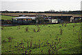
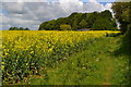
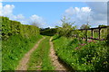
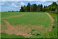
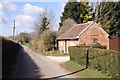

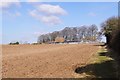
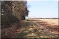
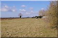
20 photos from this area
Area Information
Key information about the SP11 7AU including its size, population, and administrative classification.
- Area Type
- Postcode
- Area Size
- 96.4 hectares
- Population
- 1877
- Population Density
- 472 people/km²
House Prices in SP11 7AU
25
Properties
£517,042
Average Sold Price
£40,000
Lowest Price
£1,380,000
Highest Price
Showing 25 properties
| Address | Type | Beds | Baths | Last Sale Price | Last Sale Date | |
|---|---|---|---|---|---|---|
| 1 Farm Road, Little Park, SP11 7AU | house | 4 | 2 | £790,000 | May 2025 | |
| Little Orchard, 3 Farm Road, Little Park, SP11 7AU | Retail | 2 | 1 | £615,000 | Mar 2023 | |
| Cedar Cottage, 4 Farm Road, Little Park, SP11 7AU | Bungalow | - | - | £760,000 | Jun 2021 | |
| Red Post Cottage, 67 Farm Road, Little Park, SP11 7AU | house | - | - | £485,000 | Feb 2021 | |
| 6 Farm Road, Little Park, SP11 7AU | house | - | - | £552,500 | Jan 2020 | |
| Duckswood, 10 Farm Road, Little Park, SP11 7AU | Bungalow | - | - | £535,000 | Nov 2017 | |
| The Chestnuts, 5 Farm Road, Little Park, SP11 7AU | Bungalow | 6 | - | £483,500 | Jun 2005 | |
| 9 Farm Road, Little Park, SP11 7AU | house | - | - | £285,000 | Jul 2003 | |
| Mansion House, Farm Road, Little Park, SP11 7AU | Detached | - | - | £1,380,000 | Nov 2001 | |
| 73 Farm Road, Little Park, SP11 7AU | Semi-detached | - | - | £90,000 | Mar 1998 |
Page 1 of 3
Energy Efficiency in SP11 7AU
Amenities
Schools
| Rank | School | Type | Entry gender | Ages |
|---|
Explore more schools in this area
Go to Schools tabDemographics
Household Size
Family (3-5 people)
most common
Accommodation Type
Houses
most common
Tenure
83
majority
Ethnic Group
White
most common
Religion
N/A
most common
Household Composition
N/A
most common
Age
47
median
Adults (30-64 years)
most common
Household Deprivation
N/A
with no deprivation
NS-SEC
45
in Lower managerial occupations
Explore more demographic insights in this area
Go to Demographics tabPlanning
Planning Constraints
- Flood RiskPremium
- Ramsar Wetland SitesPremium
- Area of Outstanding Natural BeautyPremium
- Protected Nature ReservePremium
- Protected WoodlandPremium