Area Overview for SP11 6LU
Photos of SP11 6LU
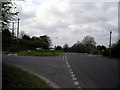
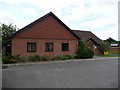
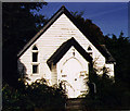
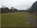
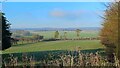
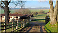
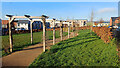
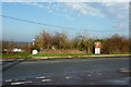
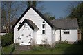
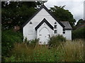
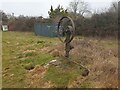
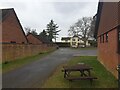
17 photos from this area
Area Information
Key information about the SP11 6LU including its size, population, and administrative classification.
- Area Type
- Postcode
- Area Size
- 18.0 hectares
- Population
- 1644
- Population Density
- 691 people/km²
House Prices in SP11 6LU
52
Properties
£568,731
Average Sold Price
£105,000
Lowest Price
£1,900,000
Highest Price
Showing 52 properties
| Address | Type | Beds | Baths | Last Sale Price | Last Sale Date | |
|---|---|---|---|---|---|---|
| Paddock View, Walworth Road, Picket Piece, Andover, SP11 6LU | house | - | - | £1,900,000 | Aug 2025 | |
| Applecross, 5A Walworth Road, Picket Piece, Andover, SP11 6LU | Detached | 4 | 2 | £695,000 | Apr 2024 | |
| Pine Croft, Walworth Road, Picket Piece, Andover, SP11 6LU | house | 5 | 3 | £775,000 | Dec 2023 | |
| Picket Piece House, Walworth Road, Picket Piece, Andover, SP11 6LU | Detached | 8 | 6 | £785,000 | Nov 2023 | |
| Millbrook, Walworth Road, Picket Piece, Andover, SP11 6LU | Detached | 5 | 3 | £590,000 | Jan 2023 | |
| 8A Walworth Road, Picket Piece, Andover, SP11 6LU | commercial | - | - | £650,000 | Dec 2021 | |
| Brookwood House, Walworth Road, Picket Piece, Andover, SP11 6LU | Bungalow | - | - | £342,000 | Jun 2012 | |
| Avalon, 5B Walworth Road, Picket Piece, Andover, SP11 6LU | house | - | - | £385,000 | Dec 2009 | |
| Amphion, Walworth Road, Picket Piece, Andover, SP11 6LU | Detached | - | - | £381,500 | Aug 2007 | |
| 12 Walworth Road, Picket Piece, Andover, SP11 6LU | Land | 2 | 2 | £250,000 | Mar 2005 |
Page 1 of 6
Energy Efficiency in SP11 6LU
Amenities
Schools
| Rank | School | Type | Entry gender | Ages |
|---|
Explore more schools in this area
Go to Schools tabDemographics
Household Size
Family (3-5 people)
most common
Accommodation Type
Houses
most common
Tenure
83
majority
Ethnic Group
White
most common
Religion
N/A
most common
Household Composition
N/A
most common
Age
47
median
Adults (30-64 years)
most common
Household Deprivation
N/A
with no deprivation
NS-SEC
46
in Lower managerial occupations
Explore more demographic insights in this area
Go to Demographics tabPlanning
Planning Constraints
- Flood RiskPremium
- Ramsar Wetland SitesPremium
- Area of Outstanding Natural BeautyPremium
- Protected Nature ReservePremium
- Protected WoodlandPremium