Area Overview for SP10 2QE
Photos of SP10 2QE

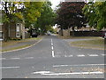
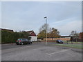
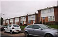
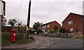
36 photos from this area
Area Information
Key information about the SP10 2QE including its size, population, and administrative classification.
- Area Type
- Postcode
- Area Size
- 9590 m²
- Population
- 1398
- Population Density
- 4750 people/km²
House Prices in SP10 2QE
27
Properties
£209,361
Average Sold Price
£80,000
Lowest Price
£305,250
Highest Price
Showing 27 properties
| Address | Type | Beds | Baths | Last Sale Price | Last Sale Date | |
|---|---|---|---|---|---|---|
| 24 Wool Grove, Andover, SP10 2QE | Terraced | 2 | 1 | £275,000 | Aug 2025 | |
| 6 Wool Grove, Andover, SP10 2QE | Terraced | 3 | 1 | £285,000 | Feb 2024 | |
| 16 Wool Grove, Andover, SP10 2QE | Terraced | 2 | 1 | £305,250 | Oct 2022 | |
| 26 Wool Grove, Andover, SP10 2QE | Terraced | 3 | 1 | £300,000 | Mar 2022 | |
| 5 Wool Grove, Andover, SP10 2QE | Terraced | 3 | - | £179,000 | Dec 2013 | |
| 18 Wool Grove, Andover, SP10 2QE | Terraced | 3 | 1 | £158,000 | Jun 2012 | |
| 15 Wool Grove, Andover, SP10 2QE | Semi-detached | - | - | £198,000 | Apr 2008 | |
| 14 Wool Grove, Andover, SP10 2QE | Terraced | - | - | £104,000 | Dec 2001 | |
| 12 Wool Grove, Andover, SP10 2QE | Terraced | - | - | £80,000 | Sep 1999 | |
| 10 Wool Grove, Andover, SP10 2QE | house | - | - | - | - |
Page 1 of 3
Energy Efficiency in SP10 2QE
Amenities
Schools
| Rank | School | Type | Entry gender | Ages |
|---|
Explore more schools in this area
Go to Schools tabDemographics
Household Size
Two person
most common
Accommodation Type
Houses
most common
Tenure
61
majority
Ethnic Group
White
most common
Religion
N/A
most common
Household Composition
N/A
most common
Age
47
median
Adults (30-64 years)
most common
Household Deprivation
N/A
with no deprivation
NS-SEC
28
in Lower managerial occupations
Explore more demographic insights in this area
Go to Demographics tabPlanning
Planning Constraints
- Flood RiskPremium
- Ramsar Wetland SitesPremium
- Area of Outstanding Natural BeautyPremium
- Protected Nature ReservePremium
- Protected WoodlandPremium