Area Overview for SP10 2AH
Photos of SP10 2AH
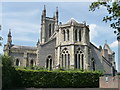
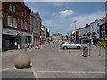
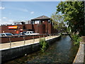
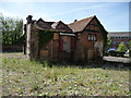
100 photos from this area
Area Information
Key information about the SP10 2AH including its size, population, and administrative classification.
- Area Type
- Postcode
- Area Size
- 1.5 hectares
- Population
- 1712
- Population Density
- 822 people/km²
House Prices in SP10 2AH
32
Properties
£276,118
Average Sold Price
£75,000
Lowest Price
£430,000
Highest Price
Showing 32 properties
| Address | Type | Beds | Baths | Last Sale Price | Last Sale Date | |
|---|---|---|---|---|---|---|
| 13 Farrs Avenue, Andover, SP10 2AH | Semi-detached | 3 | 1 | £370,000 | May 2024 | |
| 12 Farrs Avenue, Andover, SP10 2AH | Detached | 3 | - | £430,000 | Oct 2021 | |
| 14 Farrs Avenue, Andover, SP10 2AH | house | - | - | £430,000 | Sep 2021 | |
| 4 Farrs Avenue, Andover, SP10 2AH | house | - | - | £400,000 | Apr 2021 | |
| 2 Farrs Avenue, Andover, SP10 2AH | house | - | - | £430,000 | May 2019 | |
| Cherry Tree, 17 Farrs Avenue, Andover, SP10 2AH | house | - | - | £395,000 | Aug 2018 | |
| 21 Farrs Avenue, Andover, SP10 2AH | Semi-detached | 3 | 1 | £305,000 | Dec 2017 | |
| 15 Farrs Avenue, Andover, SP10 2AH | Semi-detached | 3 | 1 | £265,000 | Aug 2017 | |
| 32 Farrs Avenue, Andover, SP10 2AH | Detached | 4 | - | £395,000 | Jun 2016 | |
| Treetops, 34 Farrs Avenue, Andover, SP10 2AH | Detached | 4 | 2 | £180,000 | Jun 2013 |
Page 1 of 4
Energy Efficiency in SP10 2AH
Amenities
Schools
| Rank | School | Type | Entry gender | Ages |
|---|
Explore more schools in this area
Go to Schools tabDemographics
Household Size
Two person
most common
Accommodation Type
Houses
most common
Tenure
69
majority
Ethnic Group
White
most common
Religion
N/A
most common
Household Composition
N/A
most common
Age
47
median
Adults (30-64 years)
most common
Household Deprivation
N/A
with no deprivation
NS-SEC
36
in Lower managerial occupations
Explore more demographic insights in this area
Go to Demographics tabPlanning
Planning Constraints
- Flood RiskPremium
- Ramsar Wetland SitesPremium
- Area of Outstanding Natural BeautyPremium
- Protected Nature ReservePremium
- Protected WoodlandPremium