Area Overview for Sovereign Ward
Photos of Sovereign Ward


Area Information
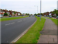
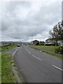
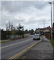
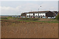
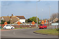
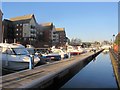
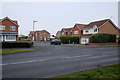
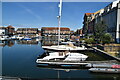
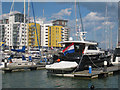
Sovereign Ward represents a distinctive transformation of former gravel extraction pits into a modern marina community. This electoral ward, which covers 2.7 square kilometres, sits within Eastbourne Borough Council in East Sussex. You are looking at a population of 2,450 residents who now live in Sovereign Harbour, a residential and commercial development opened in 1993. The area replaces The Crumbles shingle beachland with five interconnected artificial harbours named North, South, West, Outer, and Inner. Daily life here revolves around waterside living within five postcode areas marked BN23 5RG. The ward features a mix of permanent and holiday homes alongside shops, restaurants, and boating facilities. You join a community focused on leisure near the shingle beachland and the Cardboard Seafront. The development connects Eastbourne town centre with Pevensey Bay. Residents manage the harbour through the Sovereign Harbour Trust while enjoying access to coastal defences and locks. This compact area offers a suburban waterfront atmosphere distinct from the rest of the unitary authority.
- Area Type
- District Borough Unitary Ward
- Area Size
- 2.7 km²
- Population
- 2450
- Population Density
- 896 people/km²
Demographics
The community in Sovereign Ward reflects a settled population with a significant proportion of older residents. The median age is seventy years, indicating a maturity that aligns with the area's keen interest in waterside living and permanent habitation. This demographic profile suggests the location appeals to those seeking retirement or holiday home ownership. Home ownership stands at sixty-nine per cent, which signals a stable resident base rather than a transient rental market. You will find a prevalence of owner-occupied properties alongside a minority of holiday homes. The ward contains over 3,500 homes in total, comprising the specific stock within the Sovereign Harbour development. The household composition data categorises the total living arrangements within this ward boundary. While specific ethnic and religious breakdowns are not detailed in the current figures, the area maintains a structured residential pattern. The sixty-nine per cent ownership rate contrasts with newer developments that often rely heavily on the private rental sector. This high ownership figure implies strong community ties and stability within the ward.
Household Size
Accommodation Type
Tenure
Ethnic Group
Religion
Household Composition
Age
Household Deprivation
NS-SEC
Explore more demographic insights in this area
Go to Demographics tabPlanning
Planning Constraints
- Flood RiskPremium
- Ramsar Wetland SitesPremium
- Area of Outstanding Natural BeautyPremium
- Protected Nature ReservePremium
- Protected WoodlandPremium
- Crime RiskPremium