Area Overview for Southwick and Widley
Photos of Southwick and Widley
Area Information
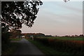
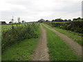
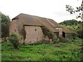
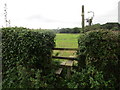
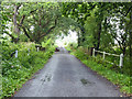
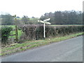
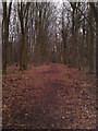
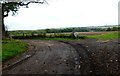
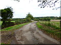
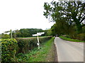
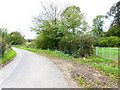
Southwick and Widley spans 18.6 km² as a civil parish in Hampshire, offering a distinct residential setting for those considering moving to the area. You will find a community defined by its quiet character rather than rapid urban development, making it a practical choice for peaceful living in Southwick and Widley. The landscape here avoids major planning constraints; there are no Ramsar wetland sites, Areas of Outstanding Natural Beauty, or protected nature reserves within the parish boundaries. This freedom from strict environmental restrictions provides a clear context for potential developers and allows you to understand the parish's development history without the usual걱정 regarding protected zones. The area contains a specific safety profile regarding flood risk, with a coverage score of 5.51 on a 0–100 scale where lower figures indicate less risk. This low flood risk classification confirms that homes in Southwick and Widley sit relative to sea level without the threat of significant water inundation. While this contrasts sharply with coastal zones elsewhere, it establishes a secure foundation for daily life. The parish does not feature protected woodland, which maintains a lower score of 14.29, meaning the landscape is mixed but lacks the heavy ancient timber constraints seen in other parts of the coast. You gain a comprehensive view of the terrain before viewing any properties, knowing exactly where safe limits lie. This factual clarity distinguishes Southwick and Widley as a place grounded in safety and predictable planning conditions.
- Area Type
- Parish
- Area Size
- 18.6 km²
- Population
- Not available
- Population Density
- Not available
Demographics
The community in Southwick and Widley presents a significant shift in population age, with a median age of 70 years old. This demographic concentration suggests that many homes in Southwick and Widley are occupied by retirees rather than families with young children. You should anticipate a quieter social environment where neighbours are likely to be mobility-minded or established long-term residents. This age profile influences local services and social activities, meaning the area caters heavily to an older population accustomed to a slower pace of life. Regarding housing tenure, 52% of residents own their homes outright or with a mortgage. This majority ownership rate indicates stability, as most households have roots in the area rather than being short-term tenants seeking better schools elsewhere. The data shows that the total household composition and accommodation types are standard for a parish of this size, though the high median age strongly implies a prevalence of single-occupancy dwellings or large family homes downscaled to one occupant. Ethnic diversity and specific religious breakdowns are not detailed in the current records, but the overall tenure structure of Southwick and Widley points to a settled community. When you assess the lifestyle here, you are buying into a retirement-focused neighbourhood where 52% of residents enjoy security of tenure, creating a distinct atmosphere different from younger university towns or commuter hubs with high rental turnover.
Household Size
Accommodation Type
Tenure
Ethnic Group
Religion
Household Composition
Age
Household Deprivation
NS-SEC
Explore more demographic insights in this area
Go to Demographics tabPlanning
Planning Constraints
- Flood RiskLocked
- Ramsar Wetland SitesLocked
- Area of Outstanding Natural BeautyLocked
- Protected Nature ReserveLocked
- Protected WoodlandLocked
- Crime RiskLocked