Area Overview for Southwick & Wickham Ward
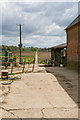
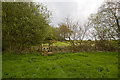
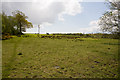
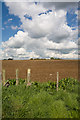
Photos of Southwick & Wickham Ward
Area Information
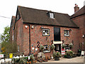
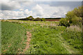
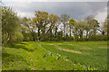
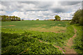
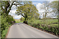
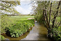
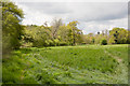
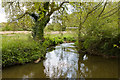
Living in Southwick & Wickham Ward offers a distinct experience defined by its history and size. This district borough unitary ward spans 45.5 km² within the Winchester City Council area in South East England. The location encompasses the historic village of Southwick and the Wickham areas, which now form part of the parish of Southwick and Widley. You will find the ward situated about one mile north of the Portsmouth boundary, placing it in a settled rural environment. The name itself derives from Old English, meaning a south trading settlement, hinting at the commercial roots beneath the current quiet streets. Southwick House, an estate manor built in 1813, anchors the geography and history of the area. Before its fire in 1838, it served as a significant landmark and later functioned as the SHAEF headquarters for D-Day planning during the Second World War. Today, the ward contains St James Church, a Grade I listed early medieval building officially known as St James without the priory gate. This is a place where modern life blends with deep historical layers, offering you a sense of continuity. The landscape is shaped by the legacy of the Southwick Estate, which still owns most village properties. Understanding this history provides essential context for what it means to call parts of this ward your home.
- Area Type
- District Borough Unitary Ward
- Area Size
- 45.5 km²
- Population
- Not available
- Population Density
- Not available
Demographics
The community in Southwick & Wickham Ward is characterised by an older population profile. The median age for residents stands at 70 years, indicating that the area is significantly older than the national average. This demographic skew suggests a neighbourhood where life moves at a deliberately slower pace. With the most common age range covering the total population, the statistics confirm that individuals over 70 make up a substantial portion of the residents. You are joining a community where longevity is common and life experience is valued. Home ownership remains a strong feature of local life. More than 59 percent of households own their homes, which creates a stable environment for long-term residents. This high rate of ownership typically means fewer transient populations and deeper community roots. Regarding accommodation and household composition, the available data confirms the broad spread of the population but lacks specific breakdowns for tenure or family type. The data also does not detail the predominant ethnic group or religious affiliations within the ward. While these figures are absent from the current statistics, the high ownership rate and older median age provide a clear picture of the area's social structure. You are looking at a settled demographic where life is centred around permanent residence rather than renting.
Household Size
Accommodation Type
Tenure
Ethnic Group
Religion
Household Composition
Age
Household Deprivation
NS-SEC
Explore more demographic insights in this area
Go to Demographics tabPlanning
Planning Constraints
- Flood RiskPremium
- Ramsar Wetland SitesPremium
- Area of Outstanding Natural BeautyPremium
- Protected Nature ReservePremium
- Protected WoodlandPremium
- Crime RiskPremium