Area Overview for Southborough & Bidborough Ward
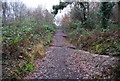
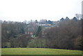
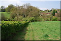
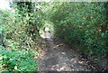
Photos of Southborough & Bidborough Ward
Area Information
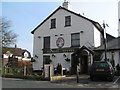
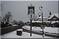
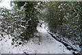
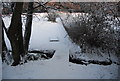
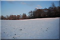
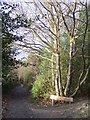
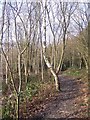
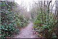
Living in Southborough & Bidborough Ward offers a distinctly historical and geographical experience within the borough of Tunbridge Wells. This electoral ward spans 14.8 km² and encompasses the town of Southborough, situated immediately north of Royal Tunbridge Wells, alongside the village of Bidborough. You will find yourself positioned near Royal Tunbridge Wells and south of Tonbridge, within the boundaries of the High Weald Area of Outstanding Natural Beauty. The ward formed part of the Manor of Southborough within the Liberty of Tunbridge after the Norman Conquest and has evolved over centuries. It includes notable features such as Southborough Common, a 71-acre conservation area owned by the town council that has hosted cricket for over 200 years. The A26 road passes directly through Southborough, providing a key transport artery. With a population of 2,941 residents, daily life here combines rural charm with proximity to larger market towns. You navigate a landscape shaped by a rich past, including its time as royal forest known as Southfrith until the mid-16th century. The area remains an established civil parish with a town council since 1974, offering a sense of local governance and community continuity that distinguishes it from many rapidly developing locations elsewhere in the South East.
- Area Type
- District Borough Unitary Ward
- Area Size
- 14.8 km²
- Population
- 2941
- Population Density
- 199 people/km²
Demographics
The community profile of Southborough & Bidborough Ward is defined by demographic realities that suggest a settled, older population structure. With a median age of 70, the area attracts retirees and older families seeking a quieter lifestyle. Data indicates that 69% of residents own their homes outright or with a mortgage, reflecting strong stability within the neighbourhood. This high home ownership rate contrasts with areas dominated by private rental markets. Although detailed statistics on household composition and predominant ethnic groups are not explicitly quantified in the provided figures, the broad demographic indicators paint a picture of a mature community. The population density stands at 199 people per square kilometre, which is relatively low for South East England and supports the rural character of the ward. You can expect a neighbourly environment where long-term residents predominate. The absence of data on specific age ranges beyond the median suggests a consistent ageing trend typical of locations nestled in the High Weald. For those considering moving here, the demographics confirm a quiet, established setting rather than a bustling hub of young professionals or new arrivals.
Household Size
Accommodation Type
Tenure
Ethnic Group
Religion
Household Composition
Age
Household Deprivation
NS-SEC
Explore more demographic insights in this area
Go to Demographics tabPlanning
Planning Constraints
- Flood RiskPremium
- Ramsar Wetland SitesPremium
- Area of Outstanding Natural BeautyPremium
- Protected Nature ReservePremium
- Protected WoodlandPremium