Area Overview for SO53 5AY
Photos of SO53 5AY
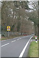
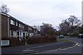
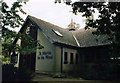
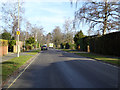
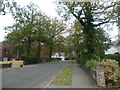
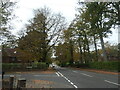
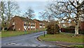
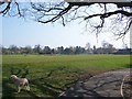
18 photos from this area
Area Information
Key information about the SO53 5AY including its size, population, and administrative classification.
- Area Type
- Postcode
- Area Size
- 1.8 hectares
- Population
- 1732
- Population Density
- 2747 people/km²
House Prices in SO53 5AY
19
Properties
£496,217
Average Sold Price
£117,000
Lowest Price
£1,200,000
Highest Price
Showing 19 properties
| Address | Type | Beds | Baths | Last Sale Price | Last Sale Date | |
|---|---|---|---|---|---|---|
| 35 Nichol Road, Chandlers Ford, SO53 5AY | Bungalow | - | - | £555,000 | Mar 2025 | |
| 19 Nichol Road, Chandlers Ford, SO53 5AY | Bungalow | 3 | 2 | £630,000 | Feb 2025 | |
| 7 Nichol Road, Chandlers Ford, SO53 5AY | house | - | - | £1,200,000 | Mar 2022 | |
| 29 Nichol Road, Chandlers Ford, SO53 5AY | Bungalow | - | - | £641,000 | Aug 2010 | |
| 9 Nichol Road, Chandlers Ford, SO53 5AY | house | - | - | £290,000 | Dec 2008 | |
| 3 Nichol Road, Chandlers Ford, SO53 5AY | Detached | 4 | 3 | £370,000 | Aug 2008 | |
| 5 Nichol Road, Chandlers Ford, SO53 5AY | Detached | 4 | 3 | £415,000 | Dec 2005 | |
| 31 Nichol Road, Chandlers Ford, SO53 5AY | Semi-detached | - | - | £247,950 | Sep 1999 | |
| 17 Nichol Road, Chandlers Ford, SO53 5AY | Detached | - | - | £117,000 | Dec 1997 | |
| 15 Nichol Road, Chandlers Ford, SO53 5AY | Bungalow | 3 | 2 | - | - |
Page 1 of 2
Energy Efficiency in SO53 5AY
Amenities
Schools
| Rank | School | Type | Entry gender | Ages |
|---|
Explore more schools in this area
Go to Schools tabDemographics
Household Size
Two person
most common
Accommodation Type
Houses
most common
Tenure
86
majority
Ethnic Group
White
most common
Religion
N/A
most common
Household Composition
N/A
most common
Age
47
median
Adults (30-64 years)
most common
Household Deprivation
N/A
with no deprivation
NS-SEC
54
in Lower managerial occupations
Explore more demographic insights in this area
Go to Demographics tabPlanning
Planning Constraints
- Flood RiskPremium
- Ramsar Wetland SitesPremium
- Area of Outstanding Natural BeautyPremium
- Protected Nature ReservePremium
- Protected WoodlandPremium