Area Overview for SO53 4LU
Photos of SO53 4LU
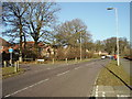
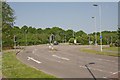
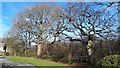
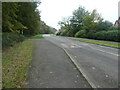
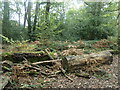

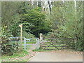
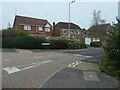
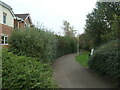
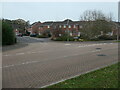
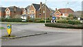
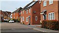
26 photos from this area
Area Information
Key information about the SO53 4LU including its size, population, and administrative classification.
- Area Type
- Postcode
- Area Size
- 8453 m²
- Population
- 1284
- Population Density
- 2753 people/km²
House Prices in SO53 4LU
35
Properties
£274,660
Average Sold Price
£88,302
Lowest Price
£465,000
Highest Price
Showing 35 properties
| Address | Type | Beds | Baths | Last Sale Price | Last Sale Date | |
|---|---|---|---|---|---|---|
| 34 Wild Arum Way, Chandlers Ford, SO53 4LU | Semi-detached | 3 | 1 | £445,000 | Aug 2025 | |
| 33 Wild Arum Way, Chandlers Ford, SO53 4LU | Semi-detached | 3 | 1 | £370,000 | Oct 2024 | |
| 14 Wild Arum Way, Chandlers Ford, SO53 4LU | Terraced | - | - | £200,000 | Jul 2024 | |
| 21 Wild Arum Way, Chandlers Ford, SO53 4LU | Semi-detached | 3 | 1 | £347,000 | Mar 2024 | |
| 5 Wild Arum Way, Chandlers Ford, SO53 4LU | Semi-detached | 3 | 1 | £380,000 | Feb 2024 | |
| 8 Wild Arum Way, Chandlers Ford, SO53 4LU | Terraced | 3 | 2 | £355,000 | Feb 2024 | |
| 7 Wild Arum Way, Chandlers Ford, SO53 4LU | Semi-detached | 3 | 2 | £410,000 | Jan 2024 | |
| 22 Wild Arum Way, Chandlers Ford, SO53 4LU | Terraced | 3 | 2 | £365,000 | Jun 2023 | |
| 15 Wild Arum Way, Chandlers Ford, SO53 4LU | Terraced | 3 | 2 | £400,000 | Jun 2023 | |
| 2 Wild Arum Way, Chandlers Ford, SO53 4LU | Retail | 3 | 2 | £465,000 | Jul 2022 |
Page 1 of 4
Energy Efficiency in SO53 4LU
Amenities
Schools
| Rank | School | Type | Entry gender | Ages |
|---|
Explore more schools in this area
Go to Schools tabDemographics
Household Size
Family (3-5 people)
most common
Accommodation Type
Houses
most common
Tenure
84
majority
Ethnic Group
White
most common
Religion
N/A
most common
Household Composition
N/A
most common
Age
47
median
Adults (30-64 years)
most common
Household Deprivation
N/A
with no deprivation
NS-SEC
54
in Lower managerial occupations
Explore more demographic insights in this area
Go to Demographics tabPlanning
Planning Constraints
- Flood RiskPremium
- Ramsar Wetland SitesPremium
- Area of Outstanding Natural BeautyPremium
- Protected Nature ReservePremium
- Protected WoodlandPremium