Area Overview for SO53 3HW
Photos of SO53 3HW


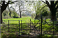
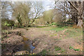

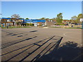
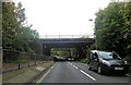
87 photos from this area
Area Information
Key information about the SO53 3HW including its size, population, and administrative classification.
- Area Type
- Postcode
- Area Size
- 1.5 hectares
- Population
- 1811
- Population Density
- 2027 people/km²
House Prices in SO53 3HW
36
Properties
£149,389
Average Sold Price
£63,000
Lowest Price
£222,500
Highest Price
Showing 36 properties
| Address | Type | Beds | Baths | Last Sale Price | Last Sale Date | |
|---|---|---|---|---|---|---|
| 70 Suffolk Drive, Chandlers Ford, SO53 3HW | house | - | - | £220,000 | Nov 2021 | |
| 28 Suffolk Drive, Chandlers Ford, SO53 3HW | Terraced | 3 | 1 | £222,500 | Aug 2021 | |
| 22 Suffolk Drive, Chandlers Ford, SO53 3HW | Terraced | 3 | 1 | £190,000 | Nov 2019 | |
| 14 Suffolk Drive, Chandlers Ford, SO53 3HW | Maisonette | 1 | 1 | £130,000 | Apr 2019 | |
| 52 Suffolk Drive, Chandlers Ford, SO53 3HW | Terraced | 3 | 1 | £220,000 | Sep 2016 | |
| 4 Suffolk Drive, Chandlers Ford, SO53 3HW | Terraced | 3 | - | £174,000 | Oct 2014 | |
| 40 Suffolk Drive, Chandlers Ford, SO53 3HW | house | - | - | £165,500 | May 2014 | |
| 50 Suffolk Drive, Chandlers Ford, SO53 3HW | Terraced | - | - | £158,500 | Jul 2007 | |
| 2 Suffolk Drive, Chandlers Ford, SO53 3HW | Terraced | - | - | £147,000 | Sep 2006 | |
| 6 Suffolk Drive, Chandlers Ford, SO53 3HW | house | - | - | £120,000 | Nov 2005 |
Page 1 of 4
Energy Efficiency in SO53 3HW
Amenities
Schools
| Rank | School | Type | Entry gender | Ages |
|---|
Explore more schools in this area
Go to Schools tabDemographics
Household Size
Family (3-5 people)
most common
Accommodation Type
Houses
most common
Tenure
46
majority
Ethnic Group
White
most common
Religion
N/A
most common
Household Composition
N/A
most common
Age
47
median
Adults (30-64 years)
most common
Household Deprivation
N/A
with no deprivation
NS-SEC
22
in Lower managerial occupations
Explore more demographic insights in this area
Go to Demographics tabPlanning
Planning Constraints
- Flood RiskPremium
- Ramsar Wetland SitesPremium
- Area of Outstanding Natural BeautyPremium
- Protected Nature ReservePremium
- Protected WoodlandPremium