Area Overview for SO53 2NP
Photos of SO53 2NP
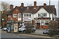

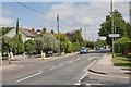
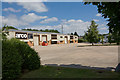

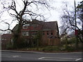


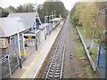
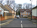
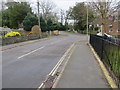
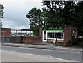
100 photos from this area
Area Information
Key information about the SO53 2NP including its size, population, and administrative classification.
- Area Type
- Postcode
- Area Size
- 2.3 hectares
- Population
- 1526
- Population Density
- 4754 people/km²
House Prices in SO53 2NP
45
Properties
£163,448
Average Sold Price
£300
Lowest Price
£351,200
Highest Price
Showing 45 properties
| Address | Type | Beds | Baths | Last Sale Price | Last Sale Date | |
|---|---|---|---|---|---|---|
| 127 Bodycoats Road, Chandlers Ford, SO53 2NP | Detached | 3 | 1 | £315,000 | Jul 2025 | |
| 87 Bodycoats Road, Chandlers Ford, SO53 2NP | Terraced | 3 | 1 | £351,200 | Dec 2024 | |
| 121 Bodycoats Road, Chandlers Ford, SO53 2NP | Terraced | 3 | 1 | £293,000 | Jan 2022 | |
| 153 Bodycoats Road, Chandlers Ford, SO53 2NP | Flat | - | - | £190,000 | May 2021 | |
| 149 Bodycoats Road, Chandlers Ford, SO53 2NP | Flat | - | - | £180,000 | Feb 2021 | |
| 109 Bodycoats Road, Chandlers Ford, SO53 2NP | Maisonette | - | - | £180,000 | May 2019 | |
| 105 Bodycoats Road, Chandlers Ford, SO53 2NP | Flat | - | - | £207,000 | Jun 2018 | |
| 155 Bodycoats Road, Chandlers Ford, SO53 2NP | Maisonette | 2 | - | £189,950 | Mar 2018 | |
| 141 Bodycoats Road, Chandlers Ford, SO53 2NP | Semi-detached | 3 | 1 | £282,000 | Mar 2018 | |
| 143 Bodycoats Road, Chandlers Ford, SO53 2NP | house | 3 | - | £272,000 | Dec 2017 |
Page 1 of 5
Energy Efficiency in SO53 2NP
Amenities
Schools
| Rank | School | Type | Entry gender | Ages |
|---|
Explore more schools in this area
Go to Schools tabDemographics
Household Size
Family (3-5 people)
most common
Accommodation Type
Houses
most common
Tenure
88
majority
Ethnic Group
White
most common
Religion
N/A
most common
Household Composition
N/A
most common
Age
47
median
Adults (30-64 years)
most common
Household Deprivation
N/A
with no deprivation
NS-SEC
37
in Lower managerial occupations
Explore more demographic insights in this area
Go to Demographics tabPlanning
Planning Constraints
- Flood RiskPremium
- Ramsar Wetland SitesPremium
- Area of Outstanding Natural BeautyPremium
- Protected Nature ReservePremium
- Protected WoodlandPremium