Area Overview for SO52 9PG
Photos of SO52 9PG
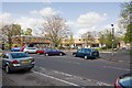
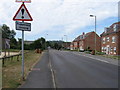
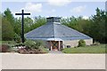
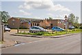
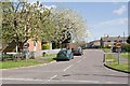
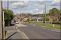
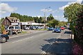
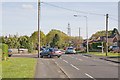

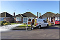
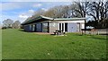
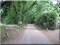
46 photos from this area
Area Information
Key information about the SO52 9PG including its size, population, and administrative classification.
- Area Type
- Postcode
- Area Size
- 3275 m²
- Population
- 1827
- Population Density
- 3700 people/km²
House Prices in SO52 9PG
14
Properties
£378,333
Average Sold Price
£207,000
Lowest Price
£535,000
Highest Price
Showing 14 properties
| Address | Type | Beds | Baths | Last Sale Price | Last Sale Date | |
|---|---|---|---|---|---|---|
| 89 Borden Way, North Baddesley, SO52 9PG | Detached | 5 | 4 | £535,000 | May 2023 | |
| 65 Borden Way, North Baddesley, SO52 9PG | Flat | - | - | £207,000 | Jan 2022 | |
| 91 Borden Way, North Baddesley, SO52 9PG | Detached | 5 | 4 | £500,000 | Dec 2018 | |
| 79 Borden Way, North Baddesley, SO52 9PG | Semi-detached | 4 | 3 | £355,000 | Feb 2018 | |
| 87 Borden Way, North Baddesley, SO52 9PG | Detached | 5 | 4 | £426,000 | Jan 2017 | |
| 81 Borden Way, North Baddesley, SO52 9PG | house | 4 | 2 | £435,000 | Jul 2016 | |
| 85 Borden Way, North Baddesley, SO52 9PG | Detached | 4 | 2 | £335,000 | May 2014 | |
| 83 Borden Way, North Baddesley, SO52 9PG | Semi-detached | - | - | £365,000 | Jun 2007 | |
| 77 Borden Way, North Baddesley, SO52 9PG | Semi-detached | - | - | £247,000 | May 2007 | |
| 73 Borden Way, North Baddesley, SO52 9PG | Flat | - | - | - | - |
Page 1 of 2
Energy Efficiency in SO52 9PG
Amenities
Schools
| Rank | School | Type | Entry gender | Ages |
|---|
Explore more schools in this area
Go to Schools tabDemographics
Household Size
Two person
most common
Accommodation Type
Houses
most common
Tenure
79
majority
Ethnic Group
White
most common
Religion
N/A
most common
Household Composition
N/A
most common
Age
47
median
Adults (30-64 years)
most common
Household Deprivation
N/A
with no deprivation
NS-SEC
40
in Lower managerial occupations
Explore more demographic insights in this area
Go to Demographics tabPlanning
Planning Constraints
- Flood RiskPremium
- Ramsar Wetland SitesPremium
- Area of Outstanding Natural BeautyPremium
- Protected Nature ReservePremium
- Protected WoodlandPremium