Area Overview for SO51 8HL
Photos of SO51 8HL

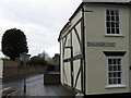
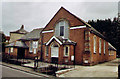

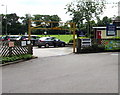

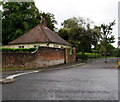

39 photos from this area
Area Information
Key information about the SO51 8HL including its size, population, and administrative classification.
- Area Type
- Postcode
- Area Size
- 1.4 hectares
- Population
- 1381
- Population Density
- 5261 people/km²
House Prices in SO51 8HL
39
Properties
£374,552
Average Sold Price
£114,000
Lowest Price
£970,000
Highest Price
Showing 39 properties
| Address | Type | Beds | Baths | Last Sale Price | Last Sale Date | |
|---|---|---|---|---|---|---|
| 12 Middlebridge Street, Romsey, SO51 8HL | Semi-detached | 4 | 3 | £970,000 | May 2025 | |
| 62 Middlebridge Street, Romsey, SO51 8HL | Terraced | 2 | 1 | £393,500 | Feb 2023 | |
| 30 Middlebridge Street, Romsey, SO51 8HL | Semi-detached | 3 | 1 | £545,000 | Oct 2022 | |
| 8 Middlebridge Street, Romsey, SO51 8HL | Terraced | 4 | 2 | £900,000 | Sep 2022 | |
| 26 Middlebridge Street, Romsey, SO51 8HL | house | - | - | £450,150 | Jun 2021 | |
| 46 Middlebridge Street, Romsey, SO51 8HL | house | - | - | £275,000 | May 2021 | |
| 56A Middlebridge Street, Romsey, SO51 8HL | house | - | - | £400,000 | Jul 2020 | |
| 28 Middlebridge Street, Romsey, SO51 8HL | Terraced | 3 | 1 | £415,000 | Jan 2018 | |
| 56 Middlebridge Street, Romsey, SO51 8HL | Terraced | 4 | 2 | £382,500 | Apr 2017 | |
| 64 Middlebridge Street, Romsey, SO51 8HL | Terraced | 2 | 1 | £210,000 | Jun 2009 |
Page 1 of 4
Energy Efficiency in SO51 8HL
Amenities
Schools
| Rank | School | Type | Entry gender | Ages |
|---|
Explore more schools in this area
Go to Schools tabDemographics
Household Size
One person
most common
Accommodation Type
Flats
most common
Tenure
47
majority
Ethnic Group
White
most common
Religion
N/A
most common
Household Composition
N/A
most common
Age
47
median
Adults (30-64 years)
most common
Household Deprivation
N/A
with no deprivation
NS-SEC
35
in Lower managerial occupations
Explore more demographic insights in this area
Go to Demographics tabPlanning
Planning Constraints
- Flood RiskPremium
- Ramsar Wetland SitesPremium
- Area of Outstanding Natural BeautyPremium
- Protected Nature ReservePremium
- Protected WoodlandPremium