Area Overview for SO51 6AN
Photos of SO51 6AN
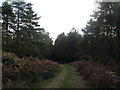
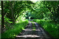
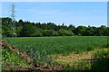
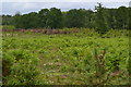
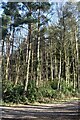

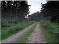
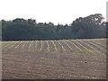
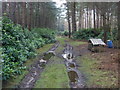
9 photos from this area
Area Information
Key information about the SO51 6AN including its size, population, and administrative classification.
- Area Type
- Postcode
- Area Size
- 3.1 km²
- Population
- 1156
- Population Density
- 67 people/km²
House Prices in SO51 6AN
23
Properties
£449,970
Average Sold Price
£110,000
Lowest Price
£833,000
Highest Price
Showing 23 properties
| Address | Type | Beds | Baths | Last Sale Price | Last Sale Date | |
|---|---|---|---|---|---|---|
| A 2 B Hire, Romsey Lodge, Old Salisbury Road, Ower, SO51 6AN | Detached | 3 | 2 | £565,000 | Nov 2023 | |
| The Roost, Salisbury Road, Ower, SO51 6AN | house | 5 | 4 | £120,000 | Oct 2021 | |
| Shelley Bungalow, Salisbury Road, Ower, SO51 6AN | Bungalow | - | - | £601,731 | Aug 2016 | |
| Belvedere, Salisbury Road, Ower, SO51 6AN | Detached | 4 | 2 | £570,000 | Aug 2015 | |
| Pendragon, Salisbury Road, Ower, SO51 6AN | Detached | 5 | 6 | £833,000 | May 2008 | |
| Highbury, Salisbury Road, Ower, SO51 6AN | Detached | - | - | £535,000 | Aug 2007 | |
| Giggleswick Cottage, Salisbury Road, Ower, SO51 6AN | Detached | 4 | 3 | £415,000 | Sep 2004 | |
| Heatherlands, Salisbury Road, Ower, SO51 6AN | Detached | 6 | - | £300,000 | Nov 1996 | |
| Noggin, Old Salisbury Road, Ower, SO51 6AN | Detached | - | - | £110,000 | Mar 1996 | |
| The Retreat, Salisbury Road, Ower, SO51 6AN | Land | - | - | - | - |
Page 1 of 3
Energy Efficiency in SO51 6AN
Amenities
Schools
| Rank | School | Type | Entry gender | Ages |
|---|
Explore more schools in this area
Go to Schools tabDemographics
Household Size
Two person
most common
Accommodation Type
Houses
most common
Tenure
89
majority
Ethnic Group
White
most common
Religion
N/A
most common
Household Composition
N/A
most common
Age
47
median
Adults (30-64 years)
most common
Household Deprivation
N/A
with no deprivation
NS-SEC
39
in Lower managerial occupations
Explore more demographic insights in this area
Go to Demographics tabPlanning
Planning Constraints
- Flood RiskPremium
- Ramsar Wetland SitesPremium
- Area of Outstanding Natural BeautyPremium
- Protected Nature ReservePremium
- Protected WoodlandPremium