Area Overview for SO51 0JS
Photos of SO51 0JS
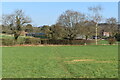
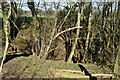


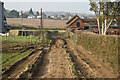
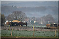
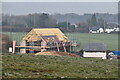
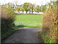
22 photos from this area
Area Information
Key information about the SO51 0JS including its size, population, and administrative classification.
- Area Type
- Postcode
- Area Size
- 89.5 hectares
- Population
- 2257
- Population Density
- 45 people/km²
House Prices in SO51 0JS
20
Properties
£1,026,214
Average Sold Price
£15,000
Lowest Price
£2,600,000
Highest Price
Showing 20 properties
| Address | Type | Beds | Baths | Last Sale Price | Last Sale Date | |
|---|---|---|---|---|---|---|
| Wisteria Cottage, Mount Lane, Lockerley, SO51 0JS | Detached | 3 | 2 | £757,500 | Mar 2025 | |
| Stradbrooke, Mount Lane, Lockerley, SO51 0JS | Semi-detached | - | - | £15,000 | Jan 2025 | |
| Westbank, Mount Lane, Lockerley, SO51 0JS | house | - | - | £2,600,000 | Oct 2022 | |
| The Rickyard, Mount Lane, Lockerley, SO51 0JS | Land | - | - | £1,080,000 | Apr 2019 | |
| 1, Manor Cottages, Mount Lane, Lockerley, SO51 0JS | Land | - | - | £720,000 | Nov 2017 | |
| 2, Manor Cottages, Mount Lane, Lockerley, SO51 0JS | house | 3 | - | £536,000 | Aug 2012 | |
| Lockerley Manor, Mount Lane, Lockerley, SO51 0JS | Detached | 10 | 7 | £1,475,000 | Aug 2006 | |
| Taihape, Mount Lane, Lockerley, SO51 0JS | house | 5 | 4 | - | - | |
| Annexe, Lockerley Manor, Mount Lane, Lockerley, SO51 0JS | Land | - | - | - | - | |
| Anna, Mount Lane, Lockerley, SO51 0JS | Land | 2 | - | - | - |
Page 1 of 2
Energy Efficiency in SO51 0JS
Amenities
Schools
| Rank | School | Type | Entry gender | Ages |
|---|
Explore more schools in this area
Go to Schools tabDemographics
Household Size
Two person
most common
Accommodation Type
Houses
most common
Tenure
66
majority
Ethnic Group
White
most common
Religion
N/A
most common
Household Composition
N/A
most common
Age
47
median
Adults (30-64 years)
most common
Household Deprivation
N/A
with no deprivation
NS-SEC
44
in Lower managerial occupations
Explore more demographic insights in this area
Go to Demographics tabPlanning
Planning Constraints
- Flood RiskPremium
- Ramsar Wetland SitesPremium
- Area of Outstanding Natural BeautyPremium
- Protected Nature ReservePremium
- Protected WoodlandPremium