Area Overview for SO50 9AU
Photos of SO50 9AU
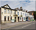
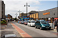
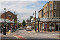
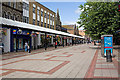
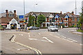

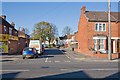
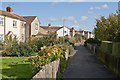
100 photos from this area
Area Information
Key information about the SO50 9AU including its size, population, and administrative classification.
- Area Type
- Postcode
- Area Size
- 2617 m²
- Population
- 2046
- Population Density
- 5822 people/km²
House Prices in SO50 9AU
15
Properties
£199,419
Average Sold Price
£54,000
Lowest Price
£362,500
Highest Price
Showing 15 properties
| Address | Type | Beds | Baths | Last Sale Price | Last Sale Date | |
|---|---|---|---|---|---|---|
| 22 Archers Road, Eastleigh, SO50 9AU | Terraced | 4 | 1 | £362,500 | Jun 2024 | |
| 20 Archers Road, Eastleigh, SO50 9AU | Terraced | 3 | 2 | £318,000 | Dec 2022 | |
| 34 Archers Road, Eastleigh, SO50 9AU | Terraced | 3 | 1 | £260,000 | Dec 2016 | |
| 26 Archers Road, Eastleigh, SO50 9AU | house | - | - | £194,950 | Sep 2010 | |
| 18 Archers Road, Eastleigh, SO50 9AU | Terraced | 3 | 1 | £169,950 | Apr 2004 | |
| 28 Archers Road, Eastleigh, SO50 9AU | Terraced | 3 | 1 | £148,950 | Jul 2003 | |
| 24 Archers Road, Eastleigh, SO50 9AU | house | - | - | £87,000 | May 2000 | |
| 36 Archers Road, Eastleigh, SO50 9AU | Terraced | 3 | 1 | £54,000 | Aug 1996 | |
| Upper Floor Flat, 14A Archers Road, Eastleigh, SO50 9AU | Flat | - | - | - | - | |
| Flat 1, 38 Archers Road, Eastleigh, SO50 9AU | Flat | - | - | - | - |
Page 1 of 2
Energy Efficiency in SO50 9AU
Amenities
Schools
| Rank | School | Type | Entry gender | Ages |
|---|
Explore more schools in this area
Go to Schools tabDemographics
Household Size
One person
most common
Accommodation Type
Houses
most common
Tenure
56
majority
Ethnic Group
White
most common
Religion
N/A
most common
Household Composition
N/A
most common
Age
47
median
Adults (30-64 years)
most common
Household Deprivation
N/A
with no deprivation
NS-SEC
33
in Lower managerial occupations
Explore more demographic insights in this area
Go to Demographics tabPlanning
Planning Constraints
- Flood RiskPremium
- Ramsar Wetland SitesPremium
- Area of Outstanding Natural BeautyPremium
- Protected Nature ReservePremium
- Protected WoodlandPremium