Area Overview for SO50 7HG
Photos of SO50 7HG
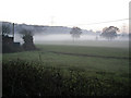

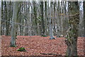


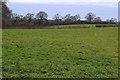
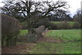
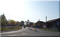
28 photos from this area
Area Information
Key information about the SO50 7HG including its size, population, and administrative classification.
- Area Type
- Postcode
- Area Size
- 9.0 hectares
- Population
- 2022
- Population Density
- 493 people/km²
House Prices in SO50 7HG
8
Properties
£456,225
Average Sold Price
£249,950
Lowest Price
£662,500
Highest Price
Showing 8 properties
| Address | Type | Beds | Baths | Last Sale Price | Last Sale Date | |
|---|---|---|---|---|---|---|
| The Stable, 182 Main Road, Fishers Pond, SO50 7HG | house | - | - | £662,500 | Sep 2010 | |
| Foulis Court Lodge, 188 Main Road, Fishers Pond, SO50 7HG | Detached | 4 | 2 | £249,950 | Aug 2004 | |
| Top Flat, Fishers Court, 186 Main Road, Fishers Pond, SO50 7HG | Detached | - | - | - | - | |
| Mobile Home At The Orchard, 184 Main Road, Fishers Pond, SO50 7HG | Detached | 3 | 2 | - | - | |
| The Flat, The Fishers Pond Restuarant, 183 Main Road, Colden Common, SO50 7HG | Flat | - | - | - | - | |
| Recycling Site, Appletons, Portsmouth Road, Fishers Pond, SO50 7HG | Industrial | - | - | - | - | |
| The Fishers Pond Restaurant, 183 Main Road, Colden Common, SO50 7HG | Leisure | - | - | - | - | |
| Foulis Cottage, 180 Main Road, Fishers Pond, SO50 7HG | house | - | - | - | - |
Energy Efficiency in SO50 7HG
Amenities
Schools
| Rank | School | Type | Entry gender | Ages |
|---|
Explore more schools in this area
Go to Schools tabDemographics
Household Size
Family (3-5 people)
most common
Accommodation Type
Houses
most common
Tenure
64
majority
Ethnic Group
White
most common
Religion
N/A
most common
Household Composition
N/A
most common
Age
47
median
Adults (30-64 years)
most common
Household Deprivation
N/A
with no deprivation
NS-SEC
41
in Lower managerial occupations
Explore more demographic insights in this area
Go to Demographics tabPlanning
Planning Constraints
- Flood RiskPremium
- Ramsar Wetland SitesPremium
- Area of Outstanding Natural BeautyPremium
- Protected Nature ReservePremium
- Protected WoodlandPremium