Area Overview for SO50 5TZ
Photos of SO50 5TZ
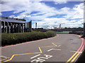
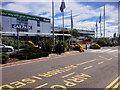
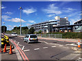
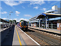
100 photos from this area
Area Information
Key information about the SO50 5TZ including its size, population, and administrative classification.
- Area Type
- Postcode
- Area Size
- 5.2 hectares
- Population
- 1705
- Population Density
- 461 people/km²
House Prices in SO50 5TZ
52
Properties
£281,231
Average Sold Price
£177,000
Lowest Price
£400,000
Highest Price
Showing 52 properties
| Address | Type | Beds | Baths | Last Sale Price | Last Sale Date | |
|---|---|---|---|---|---|---|
| 39 Viscount Gardens, Eastleigh, SO50 5TZ | Flat | - | - | £212,500 | Dec 2024 | |
| 67 Viscount Gardens, Eastleigh, SO50 5TZ | house | 3 | 2 | £380,000 | May 2024 | |
| 107 Viscount Gardens, Eastleigh, SO50 5TZ | house | 2 | - | £258,000 | Apr 2023 | |
| 53 Viscount Gardens, Eastleigh, SO50 5TZ | Terraced | 3 | 2 | £365,000 | Jan 2023 | |
| 29 Viscount Gardens, Eastleigh, SO50 5TZ | Flat | 2 | 1 | £270,000 | Nov 2022 | |
| 9 Viscount Gardens, Eastleigh, SO50 5TZ | Flat | - | - | £280,000 | Nov 2022 | |
| 75 Viscount Gardens, Eastleigh, SO50 5TZ | house | - | - | £291,500 | May 2022 | |
| 93 Viscount Gardens, Eastleigh, SO50 5TZ | house | - | - | £385,000 | May 2022 | |
| 63 Viscount Gardens, Eastleigh, SO50 5TZ | house | - | - | £360,000 | Feb 2022 | |
| 101 Viscount Gardens, Eastleigh, SO50 5TZ | Semi-detached | 3 | 2 | £330,000 | Jun 2021 |
Page 1 of 6
Energy Efficiency in SO50 5TZ
Amenities
Schools
| Rank | School | Type | Entry gender | Ages |
|---|
Explore more schools in this area
Go to Schools tabDemographics
Household Size
Family (3-5 people)
most common
Accommodation Type
Houses
most common
Tenure
51
majority
Ethnic Group
White
most common
Religion
N/A
most common
Household Composition
N/A
most common
Age
47
median
Adults (30-64 years)
most common
Household Deprivation
N/A
with no deprivation
NS-SEC
38
in Lower managerial occupations
Explore more demographic insights in this area
Go to Demographics tabPlanning
Planning Constraints
- Flood RiskPremium
- Ramsar Wetland SitesPremium
- Area of Outstanding Natural BeautyPremium
- Protected Nature ReservePremium
- Protected WoodlandPremium