Area Overview for SO50 5SY
Photos of SO50 5SY
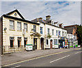
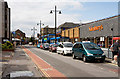
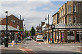
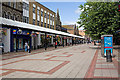
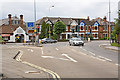
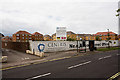
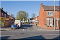
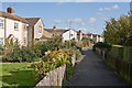
100 photos from this area
Area Information
Key information about the SO50 5SY including its size, population, and administrative classification.
- Area Type
- Postcode
- Area Size
- 3452 m²
- Population
- 1394
- Population Density
- 11491 people/km²
House Prices in SO50 5SY
15
Properties
£92,450
Average Sold Price
£60,000
Lowest Price
£181,000
Highest Price
Showing 15 properties
| Address | Type | Beds | Baths | Last Sale Price | Last Sale Date | |
|---|---|---|---|---|---|---|
| 23 Sopwith Road, Eastleigh, SO50 5SY | Flat | - | - | £93,500 | Jan 2020 | |
| 21 Sopwith Road, Eastleigh, SO50 5SY | Flat | 1 | 1 | £181,000 | Aug 2019 | |
| 5 Sopwith Road, Eastleigh, SO50 5SY | Flat | - | - | £78,750 | Dec 2016 | |
| 3 Sopwith Road, Eastleigh, SO50 5SY | Flat | - | - | £84,000 | Jan 2015 | |
| 9 Sopwith Road, Eastleigh, SO50 5SY | Flat | - | - | £71,000 | Mar 2014 | |
| 11 Sopwith Road, Eastleigh, SO50 5SY | Flat | - | - | £66,250 | Oct 2013 | |
| 29 Sopwith Road, Eastleigh, SO50 5SY | Detached | 3 | 1 | £93,000 | Apr 2008 | |
| 7 Sopwith Road, Eastleigh, SO50 5SY | Flat | - | - | £62,000 | Mar 2006 | |
| 17 Sopwith Road, Eastleigh, SO50 5SY | Flat | - | - | £60,000 | Sep 2003 | |
| 1 Sopwith Road, Eastleigh, SO50 5SY | Flat | - | - | £135,000 | Aug 2003 |
Page 1 of 2
Energy Efficiency in SO50 5SY
Amenities
Schools
| Rank | School | Type | Entry gender | Ages |
|---|
Explore more schools in this area
Go to Schools tabDemographics
Household Size
One person
most common
Accommodation Type
Flats
most common
Tenure
46
majority
Ethnic Group
White
most common
Religion
N/A
most common
Household Composition
N/A
most common
Age
47
median
Adults (30-64 years)
most common
Household Deprivation
N/A
with no deprivation
NS-SEC
36
in Lower managerial occupations
Explore more demographic insights in this area
Go to Demographics tabPlanning
Planning Constraints
- Flood RiskPremium
- Ramsar Wetland SitesPremium
- Area of Outstanding Natural BeautyPremium
- Protected Nature ReservePremium
- Protected WoodlandPremium