Area Overview for SO50 5ND
Photos of SO50 5ND
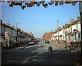
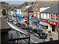
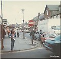
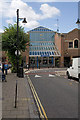
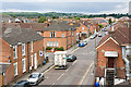
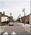
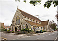
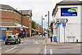
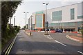
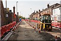
100 photos from this area
Area Information
Key information about the SO50 5ND including its size, population, and administrative classification.
- Area Type
- Postcode
- Area Size
- 3845 m²
- Population
- 1943
- Population Density
- 7810 people/km²
House Prices in SO50 5ND
18
Properties
£176,746
Average Sold Price
£51,995
Lowest Price
£297,500
Highest Price
Showing 18 properties
| Address | Type | Beds | Baths | Last Sale Price | Last Sale Date | |
|---|---|---|---|---|---|---|
| 314 High Street, Eastleigh, SO50 5ND | house | - | - | £230,000 | Mar 2025 | |
| 300 High Street, Eastleigh, SO50 5ND | Terraced | 3 | 1 | £297,500 | Sep 2022 | |
| 302 High Street, Eastleigh, SO50 5ND | house | - | - | £215,000 | May 2021 | |
| 304 High Street, Eastleigh, SO50 5ND | house | - | - | £230,000 | Mar 2021 | |
| 296 High Street, Eastleigh, SO50 5ND | house | - | - | £290,500 | Jan 2021 | |
| 328 High Street, Eastleigh, SO50 5ND | Terraced | 3 | 2 | £260,000 | Feb 2017 | |
| 326 High Street, Eastleigh, SO50 5ND | Terraced | 3 | 1 | £236,250 | Dec 2015 | |
| 298 High Street, Eastleigh, SO50 5ND | Terraced | - | - | £170,000 | Jul 2006 | |
| 316 High Street, Eastleigh, SO50 5ND | house | - | - | £140,000 | Nov 2005 | |
| 312 High Street, Eastleigh, SO50 5ND | Terraced | 3 | 1 | £92,000 | Aug 2001 |
Page 1 of 2
Energy Efficiency in SO50 5ND
Amenities
Schools
| Rank | School | Type | Entry gender | Ages |
|---|
Explore more schools in this area
Go to Schools tabDemographics
Household Size
Two person
most common
Accommodation Type
Houses
most common
Tenure
62
majority
Ethnic Group
White
most common
Religion
N/A
most common
Household Composition
N/A
most common
Age
47
median
Adults (30-64 years)
most common
Household Deprivation
N/A
with no deprivation
NS-SEC
34
in Lower managerial occupations
Explore more demographic insights in this area
Go to Demographics tabPlanning
Planning Constraints
- Flood RiskPremium
- Ramsar Wetland SitesPremium
- Area of Outstanding Natural BeautyPremium
- Protected Nature ReservePremium
- Protected WoodlandPremium