Area Overview for SO50 5JN
Photos of SO50 5JN
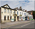
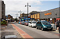
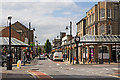
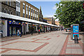
100 photos from this area
Area Information
Key information about the SO50 5JN including its size, population, and administrative classification.
- Area Type
- Postcode
- Area Size
- 8130 m²
- Population
- 2046
- Population Density
- 5822 people/km²
House Prices in SO50 5JN
37
Properties
£188,821
Average Sold Price
£65,000
Lowest Price
£325,000
Highest Price
Showing 37 properties
| Address | Type | Beds | Baths | Last Sale Price | Last Sale Date | |
|---|---|---|---|---|---|---|
| 23 Chamberlayne Road, Eastleigh, SO50 5JN | Detached | 3 | 2 | £305,000 | Oct 2023 | |
| 61 Chamberlayne Road, Eastleigh, SO50 5JN | Terraced | 3 | 1 | £292,500 | Sep 2023 | |
| 13 Chamberlayne Road, Eastleigh, SO50 5JN | Terraced | 3 | 2 | £285,000 | Aug 2023 | |
| 45 Chamberlayne Road, Eastleigh, SO50 5JN | Terraced | 1 | 2 | £325,000 | Mar 2022 | |
| 63A Chamberlayne Road, Eastleigh, SO50 5JN | Maisonette | 1 | 1 | £107,500 | Aug 2020 | |
| 29 Chamberlayne Road, Eastleigh, SO50 5JN | house | - | - | £280,000 | Aug 2019 | |
| 47 Chamberlayne Road, Eastleigh, SO50 5JN | Terraced | - | - | £150,000 | Jun 2019 | |
| 15 Chamberlayne Road, Eastleigh, SO50 5JN | Terraced | 3 | - | £225,795 | May 2016 | |
| 5 Chamberlayne Road, Eastleigh, SO50 5JN | house | 3 | - | £220,000 | Feb 2016 | |
| 43 Chamberlayne Road, Eastleigh, SO50 5JN | Terraced | 3 | 1 | £230,000 | Apr 2015 |
Page 1 of 4
Energy Efficiency in SO50 5JN
Amenities
Schools
| Rank | School | Type | Entry gender | Ages |
|---|
Explore more schools in this area
Go to Schools tabDemographics
Household Size
One person
most common
Accommodation Type
Houses
most common
Tenure
56
majority
Ethnic Group
White
most common
Religion
N/A
most common
Household Composition
N/A
most common
Age
47
median
Adults (30-64 years)
most common
Household Deprivation
N/A
with no deprivation
NS-SEC
33
in Lower managerial occupations
Explore more demographic insights in this area
Go to Demographics tabPlanning
Planning Constraints
- Flood RiskPremium
- Ramsar Wetland SitesPremium
- Area of Outstanding Natural BeautyPremium
- Protected Nature ReservePremium
- Protected WoodlandPremium