Area Overview for SO50 5FH
Photos of SO50 5FH
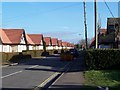
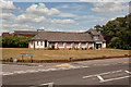

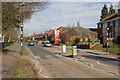
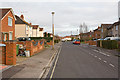

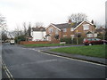
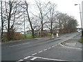
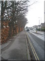
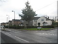
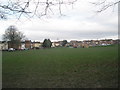
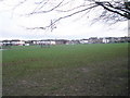
100 photos from this area
Area Information
Key information about the SO50 5FH including its size, population, and administrative classification.
- Area Type
- Postcode
- Area Size
- 5562 m²
- Population
- 1925
- Population Density
- 6121 people/km²
House Prices in SO50 5FH
14
Properties
£134,688
Average Sold Price
£50,000
Lowest Price
£265,000
Highest Price
Showing 14 properties
| Address | Type | Beds | Baths | Last Sale Price | Last Sale Date | |
|---|---|---|---|---|---|---|
| 47 Grantham Road, Eastleigh, SO50 5FH | Terraced | 3 | 1 | £265,000 | Dec 2024 | |
| 39 Grantham Road, Eastleigh, SO50 5FH | Semi-detached | 3 | - | £247,000 | Jun 2019 | |
| 37 Grantham Road, Eastleigh, SO50 5FH | Semi-detached | - | - | £160,000 | May 2006 | |
| 57 Grantham Road, Eastleigh, SO50 5FH | Semi-detached | - | - | £122,000 | Apr 2002 | |
| 53 Grantham Road, Eastleigh, SO50 5FH | Terraced | - | - | £105,000 | Mar 2001 | |
| 41 Grantham Road, Eastleigh, SO50 5FH | Semi-detached | - | - | £73,000 | Apr 1998 | |
| 49 Grantham Road, Eastleigh, SO50 5FH | Semi-detached | 3 | - | £55,500 | Feb 1997 | |
| 55 Grantham Road, Eastleigh, SO50 5FH | Terraced | - | - | £50,000 | Jun 1996 | |
| 43 Grantham Road, Eastleigh, SO50 5FH | house | - | - | - | - | |
| 31 Grantham Road, Eastleigh, SO50 5FH | house | - | - | - | - |
Page 1 of 2
Energy Efficiency in SO50 5FH
Amenities
Schools
| Rank | School | Type | Entry gender | Ages |
|---|
Explore more schools in this area
Go to Schools tabDemographics
Household Size
Family (3-5 people)
most common
Accommodation Type
Houses
most common
Tenure
65
majority
Ethnic Group
White
most common
Religion
N/A
most common
Household Composition
N/A
most common
Age
47
median
Adults (30-64 years)
most common
Household Deprivation
N/A
with no deprivation
NS-SEC
31
in Lower managerial occupations
Explore more demographic insights in this area
Go to Demographics tabPlanning
Planning Constraints
- Flood RiskPremium
- Ramsar Wetland SitesPremium
- Area of Outstanding Natural BeautyPremium
- Protected Nature ReservePremium
- Protected WoodlandPremium