Area Overview for SO50 5DR
Photos of SO50 5DR
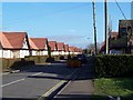
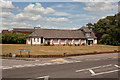
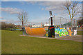
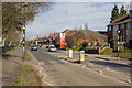
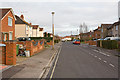

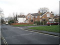
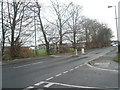
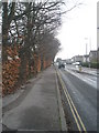
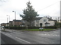
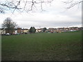
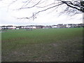
100 photos from this area
Area Information
Key information about the SO50 5DR including its size, population, and administrative classification.
- Area Type
- Postcode
- Area Size
- 5778 m²
- Population
- 1999
- Population Density
- 4837 people/km²
House Prices in SO50 5DR
20
Properties
£164,180
Average Sold Price
£56,000
Lowest Price
£265,000
Highest Price
Showing 20 properties
| Address | Type | Beds | Baths | Last Sale Price | Last Sale Date | |
|---|---|---|---|---|---|---|
| 67 Locksley Road, Eastleigh, SO50 5DR | house | - | - | £265,000 | Dec 2020 | |
| 51 Locksley Road, Eastleigh, SO50 5DR | Terraced | 2 | 1 | £222,000 | Jul 2020 | |
| 71 Locksley Road, Eastleigh, SO50 5DR | Terraced | 3 | 1 | £260,000 | May 2018 | |
| 65 Locksley Road, Eastleigh, SO50 5DR | Terraced | 3 | - | £180,000 | Jul 2014 | |
| 47 Locksley Road, Eastleigh, SO50 5DR | house | - | - | £154,000 | Jun 2014 | |
| 57 Locksley Road, Eastleigh, SO50 5DR | Terraced | 3 | - | £149,950 | Aug 2013 | |
| 77 Locksley Road, Eastleigh, SO50 5DR | house | - | - | £146,000 | May 2013 | |
| 81 Locksley Road, Eastleigh, SO50 5DR | Terraced | 3 | - | £120,000 | Jun 2009 | |
| 53 Locksley Road, Eastleigh, SO50 5DR | Semi-detached | - | - | £152,500 | Nov 2008 | |
| 63 Locksley Road, Eastleigh, SO50 5DR | Terraced | - | - | £160,000 | Aug 2007 |
Page 1 of 2
Energy Efficiency in SO50 5DR
Amenities
Schools
| Rank | School | Type | Entry gender | Ages |
|---|
Explore more schools in this area
Go to Schools tabDemographics
Household Size
Family (3-5 people)
most common
Accommodation Type
Houses
most common
Tenure
67
majority
Ethnic Group
White
most common
Religion
N/A
most common
Household Composition
N/A
most common
Age
47
median
Adults (30-64 years)
most common
Household Deprivation
N/A
with no deprivation
NS-SEC
29
in Lower managerial occupations
Explore more demographic insights in this area
Go to Demographics tabPlanning
Planning Constraints
- Flood RiskPremium
- Ramsar Wetland SitesPremium
- Area of Outstanding Natural BeautyPremium
- Protected Nature ReservePremium
- Protected WoodlandPremium