Area Overview for SO45 5AF
Photos of SO45 5AF
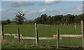
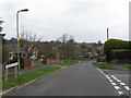
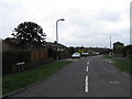
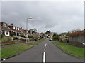


30 photos from this area
Area Information
Key information about the SO45 5AF including its size, population, and administrative classification.
- Area Type
- Postcode
- Area Size
- 1.6 hectares
- Population
- 1448
- Population Density
- 2620 people/km²
House Prices in SO45 5AF
21
Properties
£378,813
Average Sold Price
£202,000
Lowest Price
£750,000
Highest Price
Showing 21 properties
| Address | Type | Beds | Baths | Last Sale Price | Last Sale Date | |
|---|---|---|---|---|---|---|
| The Narrows, 8 Lower Mullins Lane, Hythe, SO45 5AF | house | - | - | £750,000 | Dec 2022 | |
| The Brow, 26 Lower Mullins Lane, Hythe, SO45 5AF | Detached | 4 | 2 | £575,000 | May 2019 | |
| Wellows, 34 Lower Mullins Lane, Hythe, SO45 5AF | Detached | 4 | 2 | £307,500 | Sep 2010 | |
| Charnwood, 20 Lower Mullins Lane, Hythe, SO45 5AF | Detached | 5 | - | £393,000 | Mar 2006 | |
| Amigari, 10 Lower Mullins Lane, Hythe, SO45 5AF | Detached | - | - | £213,000 | Sep 2003 | |
| Bornava, 14 Lower Mullins Lane, Hythe, SO45 5AF | Detached | - | - | £270,000 | Jun 2002 | |
| The Gable, 18 Lower Mullins Lane, Hythe, SO45 5AF | Detached | - | - | £202,000 | Jan 2002 | |
| Bay Tree Cottage, 38 Lower Mullins Lane, Hythe, SO45 5AF | Detached | - | - | £320,000 | Jun 2000 | |
| West Hill, 26A Lower Mullins Lane, Hythe, SO45 5AF | house | 4 | 2 | - | - | |
| Vinchelez House, 28 Lower Mullins Lane, Hythe, SO45 5AF | house | 5 | 4 | - | - |
Page 1 of 3
Energy Efficiency in SO45 5AF
Amenities
Schools
| Rank | School | Type | Entry gender | Ages |
|---|
Explore more schools in this area
Go to Schools tabDemographics
Household Size
Two person
most common
Accommodation Type
Houses
most common
Tenure
90
majority
Ethnic Group
White
most common
Religion
N/A
most common
Household Composition
N/A
most common
Age
47
median
Adults (30-64 years)
most common
Household Deprivation
N/A
with no deprivation
NS-SEC
40
in Lower managerial occupations
Explore more demographic insights in this area
Go to Demographics tabPlanning
Planning Constraints
- Flood RiskPremium
- Ramsar Wetland SitesPremium
- Area of Outstanding Natural BeautyPremium
- Protected Nature ReservePremium
- Protected WoodlandPremium