Area Overview for SO45 1AH
Photos of SO45 1AH

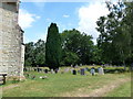


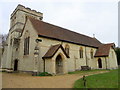
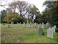
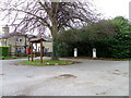

100 photos from this area
Area Information
Key information about the SO45 1AH including its size, population, and administrative classification.
- Area Type
- Postcode
- Area Size
- 38.4 hectares
- Population
- 2081
- Population Density
- 16 people/km²
House Prices in SO45 1AH
37
Properties
£425,619
Average Sold Price
£238,000
Lowest Price
£625,000
Highest Price
Showing 37 properties
| Address | Type | Beds | Baths | Last Sale Price | Last Sale Date | |
|---|---|---|---|---|---|---|
| 1, Myrtle Cottage, Road Through Exbury, Exbury, SO45 1AH | Semi-detached | - | - | £375,000 | Mar 2022 | |
| 5, New Cottages, Road Through Exbury, Exbury, SO45 1AH | Semi-detached | 3 | 1 | £522,000 | Apr 2021 | |
| The Laurels, Road Through Exbury, Exbury, SO45 1AH | Semi-detached | 3 | 2 | £589,166 | Dec 2020 | |
| Magnolia Cottage, Road Through Exbury, Exbury, SO45 1AH | Cottage | 3 | 1 | £572,500 | Oct 2020 | |
| Mitford Cottage, Road Through Exbury, Exbury, SO45 1AH | house | - | - | £299,625 | Mar 2019 | |
| Erica Cottage, Road Through Exbury, Exbury, SO45 1AH | house | - | - | £299,225 | Feb 2019 | |
| The Ramblers, Road Through Exbury, Exbury, SO45 1AH | house | 5 | - | £511,000 | Jan 2019 | |
| 3, New Cottages, Road Through Exbury, Exbury, SO45 1AH | Semi-detached | 3 | - | £500,000 | Jan 2018 | |
| 1, Elmtree Cottages, Road Through Exbury, Exbury, SO45 1AH | house | - | - | £445,500 | Aug 2015 | |
| Rose Cottage, Road Through Exbury, Exbury, SO45 1AH | house | - | - | £390,000 | Sep 2013 |
Page 1 of 4
Energy Efficiency in SO45 1AH
Amenities
Schools
| Rank | School | Type | Entry gender | Ages |
|---|
Explore more schools in this area
Go to Schools tabDemographics
Household Size
Two person
most common
Accommodation Type
Houses
most common
Tenure
61
majority
Ethnic Group
White
most common
Religion
N/A
most common
Household Composition
N/A
most common
Age
47
median
Adults (30-64 years)
most common
Household Deprivation
N/A
with no deprivation
NS-SEC
41
in Lower managerial occupations
Explore more demographic insights in this area
Go to Demographics tabPlanning
Planning Constraints
- Flood RiskPremium
- Ramsar Wetland SitesPremium
- Area of Outstanding Natural BeautyPremium
- Protected Nature ReservePremium
- Protected WoodlandPremium