Area Overview for SO43 7HD
Photos of SO43 7HD
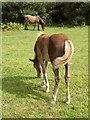
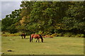
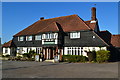
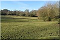
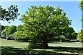
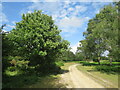

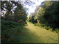
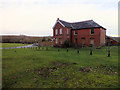
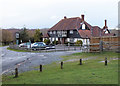

38 photos from this area
Area Information
Key information about the SO43 7HD including its size, population, and administrative classification.
- Area Type
- Postcode
- Area Size
- 3.4 km²
- Population
- 1316
- Population Density
- 20 people/km²
House Prices in SO43 7HD
25
Properties
£831,500
Average Sold Price
£140,000
Lowest Price
£1,344,000
Highest Price
Showing 25 properties
| Address | Type | Beds | Baths | Last Sale Price | Last Sale Date | |
|---|---|---|---|---|---|---|
| Rooks Farm, Road From A 31 To Brook Via Canterton, Brook, SO43 7HD | Equestrian | 4 | 2 | £1,344,000 | Feb 2019 | |
| Oaktree Cottage, Road From A 31 To Brook Via Canterton, Brook, SO43 7HD | Detached | 6 | 4 | £950,000 | May 2018 | |
| Saddlers Cottage, Road From A 31 To Brook Via Canterton, Brook, SO43 7HD | Detached | - | - | £995,000 | Jul 2012 | |
| Oaklands, Road From A 31 To Brook Via Canterton, Brook, SO43 7HD | Detached | 4 | 3 | £825,000 | Jun 2008 | |
| Canterbrook Cottage, Road From A 31 To Brook Via Canterton, Brook, SO43 7HD | house | - | - | £735,000 | Aug 2007 | |
| Lush's, Road From A 31 To Brook Via Canterton, Brook, SO43 7HD | Detached | - | - | £140,000 | May 2005 | |
| 1, Sir Walter Tyrrell, Road From A 31 To Brook Via Canterton, Brook, SO43 7HD | Detached | 5 | - | - | - | |
| Blackthornes, Road From A 31 To Brook Via Canterton, Brook, SO43 7HD | house | - | - | - | - | |
| Sir Walter Tyrrell Public House, Sir Walter Tyrrell, Road From A 31 To Brook Via Canterton, Brook, SO43 7HD | Leisure | - | - | - | - | |
| Skers Farm, Road From A 31 To Brook Via Canterton, Brook, SO43 7HD | Detached | - | - | - | - |
Page 1 of 3
Energy Efficiency in SO43 7HD
Amenities
Schools
| Rank | School | Type | Entry gender | Ages |
|---|
Explore more schools in this area
Go to Schools tabDemographics
Household Size
Two person
most common
Accommodation Type
Houses
most common
Tenure
79
majority
Ethnic Group
White
most common
Religion
N/A
most common
Household Composition
N/A
most common
Age
47
median
Adults (30-64 years)
most common
Household Deprivation
N/A
with no deprivation
NS-SEC
45
in Lower managerial occupations
Explore more demographic insights in this area
Go to Demographics tabPlanning
Planning Constraints
- Flood RiskPremium
- Ramsar Wetland SitesPremium
- Area of Outstanding Natural BeautyPremium
- Protected Nature ReservePremium
- Protected WoodlandPremium