Area Overview for SO43 7FU
Photos of SO43 7FU
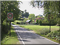
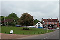

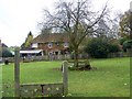
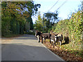

54 photos from this area
Area Information
Key information about the SO43 7FU including its size, population, and administrative classification.
- Area Type
- Postcode
- Area Size
- 13.3 hectares
- Population
- 1316
- Population Density
- 20 people/km²
House Prices in SO43 7FU
24
Properties
£432,385
Average Sold Price
£70,000
Lowest Price
£1,175,000
Highest Price
Showing 24 properties
| Address | Type | Beds | Baths | Last Sale Price | Last Sale Date | |
|---|---|---|---|---|---|---|
| The Walnuts, Seamans Lane, Minstead, SO43 7FU | Bungalow | - | - | £1,175,000 | Dec 2022 | |
| Willow Green, Seamans Lane, Minstead, SO43 7FU | Detached | 3 | - | £983,500 | May 2016 | |
| Hillview, Seamans Lane, Minstead, SO43 7FU | Bungalow | - | - | £595,000 | Apr 2013 | |
| Agisters Cottage, Seamans Lane, Minstead, SO43 7FU | Detached | 3 | 2 | £347,500 | Jun 2009 | |
| Ellen Lodge, Seamans Lane, Minstead, SO43 7FU | house | 1 | - | £497,500 | Aug 2007 | |
| Talbot Cottage, Seamans Lane, Minstead, SO43 7FU | house | 3 | - | £717,500 | Oct 2004 | |
| 2, Bishops Cottages, Seamans Lane, Minstead, SO43 7FU | Semi-detached | - | - | £250,000 | Jun 2004 | |
| April Cottage, Seamans Lane, Minstead, SO43 7FU | Detached | - | - | £250,000 | Aug 2003 | |
| The Acorns, Seamans Lane, Minstead, SO43 7FU | Detached | - | - | £235,000 | Dec 1998 | |
| Wembdon Cottage, Seamans Lane, Minstead, SO43 7FU | Detached | 4 | - | £240,000 | Jul 1998 |
Page 1 of 3
Energy Efficiency in SO43 7FU
Amenities
Schools
| Rank | School | Type | Entry gender | Ages |
|---|
Explore more schools in this area
Go to Schools tabDemographics
Household Size
Two person
most common
Accommodation Type
Houses
most common
Tenure
79
majority
Ethnic Group
White
most common
Religion
N/A
most common
Household Composition
N/A
most common
Age
47
median
Adults (30-64 years)
most common
Household Deprivation
N/A
with no deprivation
NS-SEC
45
in Lower managerial occupations
Explore more demographic insights in this area
Go to Demographics tabPlanning
Planning Constraints
- Flood RiskPremium
- Ramsar Wetland SitesPremium
- Area of Outstanding Natural BeautyPremium
- Protected Nature ReservePremium
- Protected WoodlandPremium