Area Overview for SO43 7EJ
Photos of SO43 7EJ
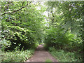
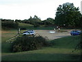
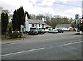
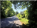
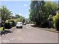
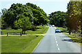
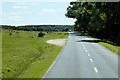
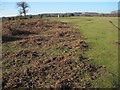
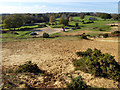
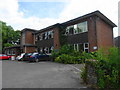
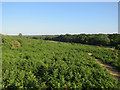
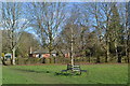
60 photos from this area
Area Information
Key information about the SO43 7EJ including its size, population, and administrative classification.
- Area Type
- Postcode
- Area Size
- 5.5 hectares
- Population
- 1559
- Population Density
- 218 people/km²
House Prices in SO43 7EJ
54
Properties
£319,523
Average Sold Price
£96,000
Lowest Price
£575,000
Highest Price
Showing 54 properties
| Address | Type | Beds | Baths | Last Sale Price | Last Sale Date | |
|---|---|---|---|---|---|---|
| 53 The Meadows, Lyndhurst, SO43 7EJ | Detached | 3 | 1 | £515,000 | Nov 2024 | |
| 51 The Meadows, Lyndhurst, SO43 7EJ | Semi-detached | 4 | 1 | £407,000 | Oct 2024 | |
| 107 The Meadows, Lyndhurst, SO43 7EJ | house | 3 | 2 | £495,000 | Oct 2024 | |
| 17 The Meadows, Lyndhurst, SO43 7EJ | Detached | - | - | £415,000 | Sep 2024 | |
| 29 The Meadows, Lyndhurst, SO43 7EJ | Detached | 3 | 1 | £480,000 | Mar 2023 | |
| 75 The Meadows, Lyndhurst, SO43 7EJ | Detached | 4 | - | £575,000 | Dec 2022 | |
| 85 The Meadows, Lyndhurst, SO43 7EJ | Detached | 3 | 1 | £518,000 | Aug 2022 | |
| 67 The Meadows, Lyndhurst, SO43 7EJ | house | - | - | £450,000 | Sep 2021 | |
| 7 The Meadows, Lyndhurst, SO43 7EJ | house | - | - | £465,000 | Dec 2020 | |
| 27 The Meadows, Lyndhurst, SO43 7EJ | Detached | 5 | - | £450,000 | Aug 2020 |
Page 1 of 6
Energy Efficiency in SO43 7EJ
Amenities
Schools
| Rank | School | Type | Entry gender | Ages |
|---|
Explore more schools in this area
Go to Schools tabDemographics
Household Size
Two person
most common
Accommodation Type
Houses
most common
Tenure
85
majority
Ethnic Group
White
most common
Religion
N/A
most common
Household Composition
N/A
most common
Age
47
median
Adults (30-64 years)
most common
Household Deprivation
N/A
with no deprivation
NS-SEC
49
in Lower managerial occupations
Explore more demographic insights in this area
Go to Demographics tabPlanning
Planning Constraints
- Flood RiskPremium
- Ramsar Wetland SitesPremium
- Area of Outstanding Natural BeautyPremium
- Protected Nature ReservePremium
- Protected WoodlandPremium