Area Overview for SO42 7YB
Photos of SO42 7YB
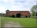
29 photos from this area
Area Information
Key information about the SO42 7YB including its size, population, and administrative classification.
- Area Type
- Postcode
- Area Size
- 19.4 hectares
- Population
- 2081
- Population Density
- 16 people/km²
House Prices in SO42 7YB
7
Properties
£1,475,000
Average Sold Price
£1,360,000
Lowest Price
£1,590,000
Highest Price
Showing 7 properties
| Address | Type | Beds | Baths | Last Sale Price | Last Sale Date | |
|---|---|---|---|---|---|---|
| Estate Yard House, High Street, Beaulieu, SO42 7YB | Detached | 4 | 3 | £1,360,000 | Jan 2023 | |
| Curtle House, High Street, Beaulieu, SO42 7YB | Detached | - | - | £1,590,000 | Oct 2000 | |
| Estate Yard Cottage, High Street, Beaulieu, SO42 7YB | Semi-detached | 2 | 2 | - | - | |
| Steffs Kitchen, Fairweathers Garden Centre, High Street, Beaulieu, SO42 7YB | Restaurant | - | - | - | - | |
| The Lodge, High Street, Beaulieu, SO42 7YB | Detached | - | - | - | - | |
| Lodge Cottage, High Street, Beaulieu, SO42 7YB | house | - | - | - | - | |
| C C Fairweather Ltd, Fairweathers Garden Centre, High Street, Beaulieu, SO42 7YB | retail_financial | - | - | - | - |
Energy Efficiency in SO42 7YB
Amenities
Schools
| Rank | School | Type | Entry gender | Ages |
|---|
Explore more schools in this area
Go to Schools tabDemographics
Household Size
Two person
most common
Accommodation Type
Houses
most common
Tenure
61
majority
Ethnic Group
White
most common
Religion
N/A
most common
Household Composition
N/A
most common
Age
47
median
Adults (30-64 years)
most common
Household Deprivation
N/A
with no deprivation
NS-SEC
41
in Lower managerial occupations
Explore more demographic insights in this area
Go to Demographics tabPlanning
Planning Constraints
- Flood RiskPremium
- Ramsar Wetland SitesPremium
- Area of Outstanding Natural BeautyPremium
- Protected Nature ReservePremium
- Protected WoodlandPremium