Area Overview for SO42 7TH
Photos of SO42 7TH
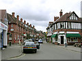
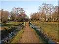
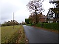
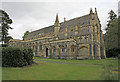
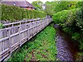
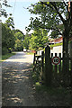
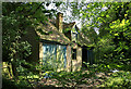
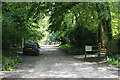

100 photos from this area
Area Information
Key information about the SO42 7TH including its size, population, and administrative classification.
- Area Type
- Postcode
- Area Size
- 2.9 hectares
- Population
- 1748
- Population Density
- 1602 people/km²
House Prices in SO42 7TH
41
Properties
£452,269
Average Sold Price
£202,000
Lowest Price
£650,000
Highest Price
Showing 41 properties
| Address | Type | Beds | Baths | Last Sale Price | Last Sale Date | |
|---|---|---|---|---|---|---|
| 21A Fathersfield, Brockenhurst, SO42 7TH | Terraced | 3 | 2 | £430,000 | May 2023 | |
| 34 Fathersfield, Brockenhurst, SO42 7TH | Semi-detached | 3 | 2 | £590,000 | May 2022 | |
| Angel Villa, 1A Fathersfield, Brockenhurst, SO42 7TH | Detached | 4 | 2 | £650,000 | Sep 2020 | |
| 12 Fathersfield, Brockenhurst, SO42 7TH | Semi-detached | 4 | 1 | £575,000 | Jul 2020 | |
| Hinton Villa, Fathersfield, Brockenhurst, SO42 7TH | Detached | 3 | 1 | £637,000 | Nov 2016 | |
| 2 Fathersfield, Brockenhurst, SO42 7TH | Semi-detached | 5 | 2 | £402,500 | Mar 2013 | |
| 3 Fathersfield, Brockenhurst, SO42 7TH | Semi-detached | 4 | 3 | £420,000 | Aug 2010 | |
| Fulford House, Fathersfield, Brockenhurst, SO42 7TH | Detached | 5 | 3 | £625,000 | Jul 2010 | |
| 13 Fathersfield, Brockenhurst, SO42 7TH | house | 3 | - | £350,000 | Jun 2010 | |
| The Cherries, 4 Fathersfield, Brockenhurst, SO42 7TH | house | 4 | - | £445,000 | Jun 2010 |
Page 1 of 5
Energy Efficiency in SO42 7TH
Amenities
Schools
| Rank | School | Type | Entry gender | Ages |
|---|
Explore more schools in this area
Go to Schools tabDemographics
Household Size
One person
most common
Accommodation Type
Houses
most common
Tenure
69
majority
Ethnic Group
White
most common
Religion
N/A
most common
Household Composition
N/A
most common
Age
47
median
Adults (30-64 years)
most common
Household Deprivation
N/A
with no deprivation
NS-SEC
43
in Lower managerial occupations
Explore more demographic insights in this area
Go to Demographics tabPlanning
Planning Constraints
- Flood RiskPremium
- Ramsar Wetland SitesPremium
- Area of Outstanding Natural BeautyPremium
- Protected Nature ReservePremium
- Protected WoodlandPremium