Area Overview for SO42 7SF
Photos of SO42 7SF
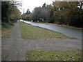

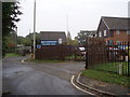
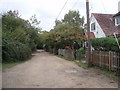
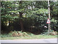
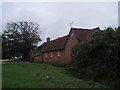

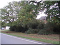
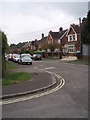
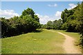
61 photos from this area
Area Information
Key information about the SO42 7SF including its size, population, and administrative classification.
- Area Type
- Postcode
- Area Size
- 1.1 hectares
- Population
- 1737
- Population Density
- 36 people/km²
House Prices in SO42 7SF
15
Properties
£311,086
Average Sold Price
£103,000
Lowest Price
£555,000
Highest Price
Showing 15 properties
| Address | Type | Beds | Baths | Last Sale Price | Last Sale Date | |
|---|---|---|---|---|---|---|
| Radnor, Woodlands Road, Brockenhurst, SO42 7SF | Semi-detached | - | - | £435,000 | Apr 2012 | |
| Hurlands, Woodlands Road, Brockenhurst, SO42 7SF | house | 3 | - | £555,000 | Jun 2010 | |
| Brackendene, Woodlands Road, Brockenhurst, SO42 7SF | Semi-detached | - | - | £330,000 | Apr 2006 | |
| Rosemead, Woodlands Road, Brockenhurst, SO42 7SF | Semi-detached | - | - | £310,000 | Jun 2004 | |
| Cherry Trees, 6 Woodlands Road, Brockenhurst, SO42 7SF | Semi-detached | - | - | £315,000 | May 2004 | |
| Lynton, Woodlands Road, Brockenhurst, SO42 7SF | Semi-detached | - | - | £300,000 | Mar 2004 | |
| The Cottage, Woodlands Road, Brockenhurst, SO42 7SF | Detached | - | - | £370,000 | Jul 2003 | |
| Twin Rowan, Woodlands Road, Brockenhurst, SO42 7SF | Semi-detached | - | - | £292,500 | Oct 2002 | |
| Maroochydore, Woodlands Road, Brockenhurst, SO42 7SF | Detached | - | - | £249,950 | Apr 2000 | |
| Woodlands Cottage, Woodlands Road, Brockenhurst, SO42 7SF | house | - | - | £161,500 | Aug 1998 |
Page 1 of 2
Energy Efficiency in SO42 7SF
Amenities
Schools
| Rank | School | Type | Entry gender | Ages |
|---|
Explore more schools in this area
Go to Schools tabDemographics
Household Size
Two person
most common
Accommodation Type
Houses
most common
Tenure
89
majority
Ethnic Group
White
most common
Religion
N/A
most common
Household Composition
N/A
most common
Age
47
median
Adults (30-64 years)
most common
Household Deprivation
N/A
with no deprivation
NS-SEC
54
in Lower managerial occupations
Explore more demographic insights in this area
Go to Demographics tabPlanning
Planning Constraints
- Flood RiskPremium
- Ramsar Wetland SitesPremium
- Area of Outstanding Natural BeautyPremium
- Protected Nature ReservePremium
- Protected WoodlandPremium