Area Overview for SO42 7QA
Photos of SO42 7QA
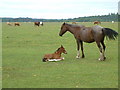
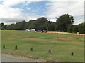
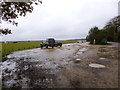
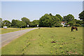
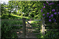
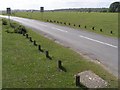
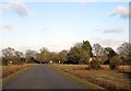
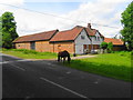
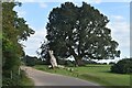
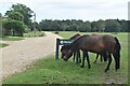
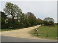
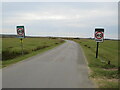
35 photos from this area
Area Information
Key information about the SO42 7QA including its size, population, and administrative classification.
- Area Type
- Postcode
- Area Size
- 12.4 hectares
- Population
- 1737
- Population Density
- 36 people/km²
House Prices in SO42 7QA
28
Properties
£980,467
Average Sold Price
£342,500
Lowest Price
£2,100,000
Highest Price
Showing 28 properties
| Address | Type | Beds | Baths | Last Sale Price | Last Sale Date | |
|---|---|---|---|---|---|---|
| Greenholm, North Weirs, Brockenhurst, SO42 7QA | Detached | 4 | 3 | £1,475,000 | Dec 2025 | |
| 5, Brittons Cottages, North Weirs, Brockenhurst, SO42 7QA | Terraced | 2 | 1 | £575,000 | Nov 2025 | |
| Knoleforth, North Weirs, Brockenhurst, SO42 7QA | Detached | 5 | 3 | £1,800,000 | Apr 2025 | |
| Broadlands Cottage, North Weirs, Brockenhurst, SO42 7QA | Detached | 4 | - | £2,100,000 | May 2022 | |
| Ivy Cottage, North Weirs, Brockenhurst, SO42 7QA | house | - | - | £716,000 | Dec 2016 | |
| The Folly, North Weirs, Brockenhurst, SO42 7QA | Detached | 3 | - | £810,000 | Dec 2016 | |
| Thatched Cottage, North Weirs, Brockenhurst, SO42 7QA | Detached | - | - | £1,700,000 | Oct 2015 | |
| Hawthorn Cottage, North Weirs, Brockenhurst, SO42 7QA | Detached | - | - | £550,000 | Nov 2012 | |
| Thornacre, North Weirs, Brockenhurst, SO42 7QA | house | - | - | £1,750,000 | Apr 2011 | |
| Oakmere, North Weirs, Brockenhurst, SO42 7QA | house | - | - | £785,000 | Nov 2005 |
Page 1 of 3
Energy Efficiency in SO42 7QA
Amenities
Schools
| Rank | School | Type | Entry gender | Ages |
|---|
Explore more schools in this area
Go to Schools tabDemographics
Household Size
Two person
most common
Accommodation Type
Houses
most common
Tenure
89
majority
Ethnic Group
White
most common
Religion
N/A
most common
Household Composition
N/A
most common
Age
47
median
Adults (30-64 years)
most common
Household Deprivation
N/A
with no deprivation
NS-SEC
54
in Lower managerial occupations
Explore more demographic insights in this area
Go to Demographics tabPlanning
Planning Constraints
- Flood RiskPremium
- Ramsar Wetland SitesPremium
- Area of Outstanding Natural BeautyPremium
- Protected Nature ReservePremium
- Protected WoodlandPremium