Area Overview for SO41 9LW
Photos of SO41 9LW
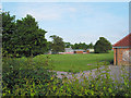
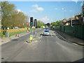
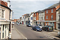
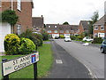

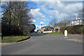
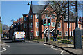
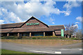
67 photos from this area
Area Information
Key information about the SO41 9LW including its size, population, and administrative classification.
- Area Type
- Postcode
- Area Size
- 1.2 hectares
- Population
- 2031
- Population Density
- 3452 people/km²
House Prices in SO41 9LW
39
Properties
£242,635
Average Sold Price
£75,000
Lowest Price
£415,000
Highest Price
Showing 39 properties
| Address | Type | Beds | Baths | Last Sale Price | Last Sale Date | |
|---|---|---|---|---|---|---|
| 35 Bramble Walk, Lymington, SO41 9LW | Terraced | 3 | 1 | £295,000 | Mar 2025 | |
| 9 Bramble Walk, Lymington, SO41 9LW | Terraced | 3 | 1 | £330,000 | Aug 2024 | |
| 4 Bramble Walk, Lymington, SO41 9LW | Terraced | 3 | 1 | £415,000 | Sep 2022 | |
| 21 Bramble Walk, Lymington, SO41 9LW | Terraced | 3 | 1 | £410,000 | Jul 2022 | |
| 22 Bramble Walk, Lymington, SO41 9LW | Detached | 3 | 1 | £360,000 | Jun 2021 | |
| 33 Bramble Walk, Lymington, SO41 9LW | Terraced | 3 | 1 | £315,000 | Mar 2021 | |
| 38 Bramble Walk, Lymington, SO41 9LW | Terraced | 3 | 1 | £315,000 | Jan 2021 | |
| 25 Bramble Walk, Lymington, SO41 9LW | Semi-detached | 3 | 1 | £315,000 | Nov 2020 | |
| 23 Bramble Walk, Lymington, SO41 9LW | Semi-detached | 3 | 1 | £340,000 | Oct 2019 | |
| 37 Bramble Walk, Lymington, SO41 9LW | Terraced | 3 | 1 | £280,000 | May 2019 |
Page 1 of 4
Energy Efficiency in SO41 9LW
Amenities
Schools
| Rank | School | Type | Entry gender | Ages |
|---|
Explore more schools in this area
Go to Schools tabDemographics
Household Size
Two person
most common
Accommodation Type
Houses
most common
Tenure
66
majority
Ethnic Group
White
most common
Religion
N/A
most common
Household Composition
N/A
most common
Age
47
median
Adults (30-64 years)
most common
Household Deprivation
N/A
with no deprivation
NS-SEC
40
in Lower managerial occupations
Explore more demographic insights in this area
Go to Demographics tabPlanning
Planning Constraints
- Flood RiskPremium
- Ramsar Wetland SitesPremium
- Area of Outstanding Natural BeautyPremium
- Protected Nature ReservePremium
- Protected WoodlandPremium