Area Overview for SO41 9ET
Photos of SO41 9ET
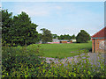
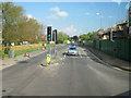
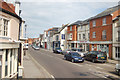
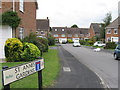
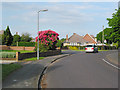
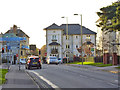
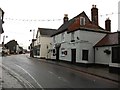
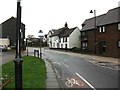

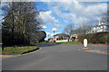
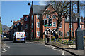
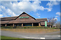
67 photos from this area
Area Information
Key information about the SO41 9ET including its size, population, and administrative classification.
- Area Type
- Postcode
- Area Size
- 6282 m²
- Population
- 1677
- Population Density
- 1011 people/km²
House Prices in SO41 9ET
14
Properties
£425,500
Average Sold Price
£310,000
Lowest Price
£765,000
Highest Price
Showing 14 properties
| Address | Type | Beds | Baths | Last Sale Price | Last Sale Date | |
|---|---|---|---|---|---|---|
| 3 Cavendish Place, Lymington, SO41 9ET | Flat | - | - | £475,000 | Jul 2023 | |
| 8 Cavendish Place, Lymington, SO41 9ET | Flat | - | - | £502,000 | Nov 2022 | |
| Walnut Cottage, 14 Cavendish Place, Lymington, SO41 9ET | Detached | 4 | 2 | £765,000 | Sep 2022 | |
| 11 Cavendish Place, Lymington, SO41 9ET | Flat | - | - | £425,000 | Jun 2020 | |
| 7 Cavendish Place, Lymington, SO41 9ET | Flat | - | - | £415,000 | Aug 2019 | |
| 10 Cavendish Place, Lymington, SO41 9ET | Flat | - | - | £405,000 | Mar 2018 | |
| 6 Cavendish Place, Lymington, SO41 9ET | Flat | - | - | £340,000 | Nov 2016 | |
| 2 Cavendish Place, Lymington, SO41 9ET | Flat | - | - | £335,000 | Jul 2015 | |
| 1 Cavendish Place, Lymington, SO41 9ET | Flat | 3 | 2 | £345,000 | Feb 2015 | |
| 13 Cavendish Place, Lymington, SO41 9ET | Detached | 3 | - | £515,000 | Jan 2015 |
Page 1 of 2
Energy Efficiency in SO41 9ET
Amenities
Schools
| Rank | School | Type | Entry gender | Ages |
|---|
Explore more schools in this area
Go to Schools tabDemographics
Household Size
One person
most common
Accommodation Type
Houses
most common
Tenure
60
majority
Ethnic Group
White
most common
Religion
N/A
most common
Household Composition
N/A
most common
Age
47
median
Adults (30-64 years)
most common
Household Deprivation
N/A
with no deprivation
NS-SEC
33
in Lower managerial occupations
Explore more demographic insights in this area
Go to Demographics tabPlanning
Planning Constraints
- Flood RiskPremium
- Ramsar Wetland SitesPremium
- Area of Outstanding Natural BeautyPremium
- Protected Nature ReservePremium
- Protected WoodlandPremium