Area Overview for SO41 9BW
Photos of SO41 9BW
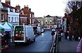
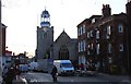
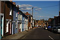
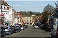

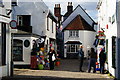
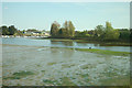

100 photos from this area
Area Information
Key information about the SO41 9BW including its size, population, and administrative classification.
- Area Type
- Postcode
- Area Size
- 1.2 hectares
- Population
- 1629
- Population Density
- 2893 people/km²
House Prices in SO41 9BW
21
Properties
£360,993
Average Sold Price
£82,000
Lowest Price
£695,000
Highest Price
Showing 21 properties
| Address | Type | Beds | Baths | Last Sale Price | Last Sale Date | |
|---|---|---|---|---|---|---|
| 33 North Close, Lymington, SO41 9BW | Semi-detached | 3 | 1 | £460,000 | Mar 2025 | |
| 35 North Close, Lymington, SO41 9BW | Semi-detached | 3 | 1 | £457,500 | Nov 2023 | |
| 37 North Close, Lymington, SO41 9BW | Semi-detached | 4 | 2 | £695,000 | Mar 2022 | |
| 31 North Close, Lymington, SO41 9BW | house | 3 | - | £299,950 | Aug 2011 | |
| 39 North Close, Lymington, SO41 9BW | house | - | - | £292,500 | Jul 2011 | |
| 49 North Close, Lymington, SO41 9BW | Semi-detached | - | - | £240,000 | Aug 2005 | |
| 43 North Close, Lymington, SO41 9BW | Semi-detached | - | - | £82,000 | Aug 1997 | |
| Stonham Housing Association Ltd, 25A North Close, Lymington, SO41 9BW | commercial | - | - | - | - | |
| Flat 2, 25A North Close, Lymington, SO41 9BW | Flat | - | - | - | - | |
| Flat 5, 25A North Close, Lymington, SO41 9BW | Flat | - | - | - | - |
Page 1 of 3
Energy Efficiency in SO41 9BW
Amenities
Schools
| Rank | School | Type | Entry gender | Ages |
|---|
Explore more schools in this area
Go to Schools tabDemographics
Household Size
One person
most common
Accommodation Type
Flats
most common
Tenure
55
majority
Ethnic Group
White
most common
Religion
N/A
most common
Household Composition
N/A
most common
Age
47
median
Elderly (65+ years)
most common
Household Deprivation
N/A
with no deprivation
NS-SEC
39
in Lower managerial occupations
Explore more demographic insights in this area
Go to Demographics tabPlanning
Planning Constraints
- Flood RiskPremium
- Ramsar Wetland SitesPremium
- Area of Outstanding Natural BeautyPremium
- Protected Nature ReservePremium
- Protected WoodlandPremium