Area Overview for SO41 8PD
Photos of SO41 8PD
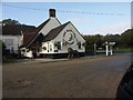

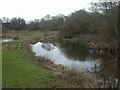
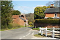
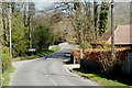
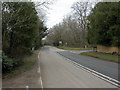
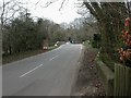
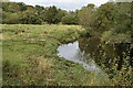
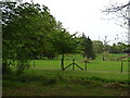

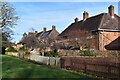

42 photos from this area
Area Information
Key information about the SO41 8PD including its size, population, and administrative classification.
- Area Type
- Postcode
- Area Size
- 14.1 hectares
- Population
- 1548
- Population Density
- 79 people/km²
House Prices in SO41 8PD
11
Properties
£862,789
Average Sold Price
£355,000
Lowest Price
£1,575,000
Highest Price
Showing 11 properties
| Address | Type | Beds | Baths | Last Sale Price | Last Sale Date | |
|---|---|---|---|---|---|---|
| Twyford Cottage, Boldre Lane, Boldre, SO41 8PD | Detached | 4 | 3 | £1,575,000 | Mar 2024 | |
| Post Office Cottage, Boldre Lane, Boldre, SO41 8PD | Detached | 3 | 3 | £735,000 | Dec 2019 | |
| Riverway, Boldre Lane, Boldre, SO41 8PD | Semi-detached | 4 | 1 | £660,000 | Jul 2018 | |
| Herling House, Boldre Lane, Boldre, SO41 8PD | Detached | 5 | 3 | £920,100 | Feb 2018 | |
| Old School House, Boldre Lane, Boldre, SO41 8PD | Detached | 3 | - | £1,150,000 | Oct 2017 | |
| Riverside Cottage, Boldre Lane, Boldre, SO41 8PD | Land | 3 | - | £355,000 | Jan 2013 | |
| Boldre Bridge Cottage, Boldre Lane, Boldre, SO41 8PD | Detached | - | - | £875,000 | Oct 2010 | |
| Paddock Cottage, Boldre Lane, Boldre, SO41 8PD | Detached | - | - | £840,000 | Feb 2008 | |
| St Tudy, Boldre Lane, Boldre, SO41 8PD | Detached | - | - | £655,000 | Nov 2006 | |
| Boldre Lane Cottage, Boldre Lane, Boldre, SO41 8PD | Semi-detached | 4 | - | - | - |
Page 1 of 2
Energy Efficiency in SO41 8PD
Amenities
Schools
| Rank | School | Type | Entry gender | Ages |
|---|
Explore more schools in this area
Go to Schools tabDemographics
Household Size
Two person
most common
Accommodation Type
Houses
most common
Tenure
76
majority
Ethnic Group
White
most common
Religion
N/A
most common
Household Composition
N/A
most common
Age
47
median
Adults (30-64 years)
most common
Household Deprivation
N/A
with no deprivation
NS-SEC
43
in Lower managerial occupations
Explore more demographic insights in this area
Go to Demographics tabPlanning
Planning Constraints
- Flood RiskPremium
- Ramsar Wetland SitesPremium
- Area of Outstanding Natural BeautyPremium
- Protected Nature ReservePremium
- Protected WoodlandPremium