Area Overview for SO41 6AN
Photos of SO41 6AN

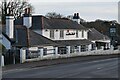
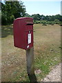
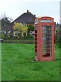
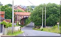
39 photos from this area
Area Information
Key information about the SO41 6AN including its size, population, and administrative classification.
- Area Type
- Postcode
- Area Size
- 1.3 hectares
- Population
- 2114
- Population Density
- 143 people/km²
House Prices in SO41 6AN
18
Properties
£527,922
Average Sold Price
£104,000
Lowest Price
£935,000
Highest Price
Showing 18 properties
| Address | Type | Beds | Baths | Last Sale Price | Last Sale Date | |
|---|---|---|---|---|---|---|
| Foxglove Cottage, St James Road, Sway, SO41 6AN | Semi-detached | 3 | 2 | £675,000 | Aug 2022 | |
| Robindell, Manchester Road, Sway, SO41 6AN | house | - | - | £567,500 | Aug 2020 | |
| St James House, St James Road, Sway, SO41 6AN | house | 2 | 1 | £935,000 | Oct 2019 | |
| Nuthatch Cottage, St James Road, Sway, SO41 6AN | Semi-detached | 4 | 2 | £519,000 | Oct 2019 | |
| St Julian, St James Road, Sway, SO41 6AN | Detached | 4 | - | £575,000 | Aug 2017 | |
| Eider Cottage, St James Road, Sway, SO41 6AN | house | - | - | £433,000 | May 2016 | |
| Hawthorn Cottage, St James Road, Sway, SO41 6AN | house | - | - | £490,000 | Feb 2016 | |
| Forest Way, St James Road, Sway, SO41 6AN | Bungalow | - | - | £452,800 | Jun 2015 | |
| Laburnum Cottage, St James Road, Sway, SO41 6AN | Semi-detached | - | - | £104,000 | Sep 1997 | |
| Gold Heath, St James Road, Sway, SO41 6AN | Bungalow | 3 | 2 | - | - |
Page 1 of 2
Energy Efficiency in SO41 6AN
Amenities
Schools
| Rank | School | Type | Entry gender | Ages |
|---|
Explore more schools in this area
Go to Schools tabDemographics
Household Size
Two person
most common
Accommodation Type
Houses
most common
Tenure
87
majority
Ethnic Group
White
most common
Religion
N/A
most common
Household Composition
N/A
most common
Age
47
median
Adults (30-64 years)
most common
Household Deprivation
N/A
with no deprivation
NS-SEC
44
in Lower managerial occupations
Explore more demographic insights in this area
Go to Demographics tabPlanning
Planning Constraints
- Flood RiskPremium
- Ramsar Wetland SitesPremium
- Area of Outstanding Natural BeautyPremium
- Protected Nature ReservePremium
- Protected WoodlandPremium