Area Overview for SO41 3RN
Photos of SO41 3RN
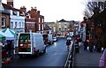
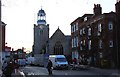
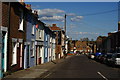
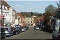

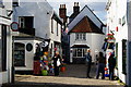
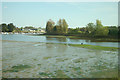
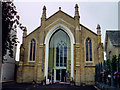
100 photos from this area
Area Information
Key information about the SO41 3RN including its size, population, and administrative classification.
- Area Type
- Postcode
- Area Size
- 1.3 hectares
- Population
- 1593
- Population Density
- 2223 people/km²
House Prices in SO41 3RN
14
Properties
£1,194,643
Average Sold Price
£200,000
Lowest Price
£3,500,000
Highest Price
Showing 14 properties
| Address | Type | Beds | Baths | Last Sale Price | Last Sale Date | |
|---|---|---|---|---|---|---|
| Endeavour, Grove Road, Lymington, SO41 3RN | Terraced | 3 | 3 | £750,000 | Jan 2023 | |
| Mary Rose, Grove Road, Lymington, SO41 3RN | house | - | - | £762,500 | Nov 2021 | |
| Little Hayes, Grove Road, Lymington, SO41 3RN | Detached | 4 | - | £3,500,000 | Jan 2020 | |
| Santa Maria, Grove Road, Lymington, SO41 3RN | house | - | - | £625,000 | Mar 2018 | |
| East Hayes Cottage, Grove Road, Lymington, SO41 3RN | Cottage | 1 | - | £575,000 | Jun 2014 | |
| South Hayes, Grove Road, Lymington, SO41 3RN | Detached | 6 | 4 | £1,950,000 | Feb 2008 | |
| Mayflower, Grove Road, Lymington, SO41 3RN | Semi-detached | 3 | 2 | £200,000 | Dec 1998 | |
| Hayes Orchard, Grove Road, Lymington, SO41 3RN | Detached | 3 | 2 | - | - | |
| Hayes Barn, Grove Road, Lymington, SO41 3RN | Detached | 4 | - | - | - | |
| 1, Captains Corner, Grove Road, Lymington, SO41 3RN | Flat | - | - | - | - |
Page 1 of 2
Energy Efficiency in SO41 3RN
Amenities
Schools
| Rank | School | Type | Entry gender | Ages |
|---|
Explore more schools in this area
Go to Schools tabDemographics
Household Size
Two person
most common
Accommodation Type
Houses
most common
Tenure
76
majority
Ethnic Group
White
most common
Religion
N/A
most common
Household Composition
N/A
most common
Age
47
median
Elderly (65+ years)
most common
Household Deprivation
N/A
with no deprivation
NS-SEC
49
in Lower managerial occupations
Explore more demographic insights in this area
Go to Demographics tabPlanning
Planning Constraints
- Flood RiskPremium
- Ramsar Wetland SitesPremium
- Area of Outstanding Natural BeautyPremium
- Protected Nature ReservePremium
- Protected WoodlandPremium