Area Overview for SO41 3QB
Photos of SO41 3QB
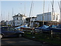

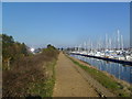
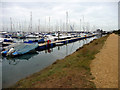
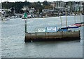

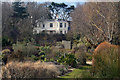

100 photos from this area
Area Information
Key information about the SO41 3QB including its size, population, and administrative classification.
- Area Type
- Postcode
- Area Size
- 4229 m²
- Population
- 1593
- Population Density
- 2223 people/km²
House Prices in SO41 3QB
6
Properties
£1,343,750
Average Sold Price
£1,200,000
Lowest Price
£1,495,000
Highest Price
Showing 6 properties
| Address | Type | Beds | Baths | Last Sale Price | Last Sale Date | |
|---|---|---|---|---|---|---|
| 41 Westfield Road, Lymington, SO41 3QB | Detached | 5 | 2 | £1,200,000 | Oct 2024 | |
| 45 Westfield Road, Lymington, SO41 3QB | Retail | 4 | 2 | £1,220,000 | Nov 2021 | |
| Birchcroft, 29 Westfield Road, Lymington, SO41 3QB | Detached | 6 | 4 | £1,495,000 | Nov 2016 | |
| Salterns Mead, 47 Westfield Road, Lymington, SO41 3QB | Detached | 5 | - | £1,460,000 | Nov 2015 | |
| Annexe, Birchcroft, 29 Westfield Road, Lymington, SO41 3QB | Flat | - | - | - | - | |
| 43 Westfield Road, Lymington, SO41 3QB | Detached | - | - | - | - |
Energy Efficiency in SO41 3QB
Amenities
Schools
| Rank | School | Type | Entry gender | Ages |
|---|
Explore more schools in this area
Go to Schools tabDemographics
Household Size
Two person
most common
Accommodation Type
Houses
most common
Tenure
76
majority
Ethnic Group
White
most common
Religion
N/A
most common
Household Composition
N/A
most common
Age
47
median
Elderly (65+ years)
most common
Household Deprivation
N/A
with no deprivation
NS-SEC
49
in Lower managerial occupations
Explore more demographic insights in this area
Go to Demographics tabPlanning
Planning Constraints
- Flood RiskPremium
- Ramsar Wetland SitesPremium
- Area of Outstanding Natural BeautyPremium
- Protected Nature ReservePremium
- Protected WoodlandPremium