Area Overview for SO41 0XS
Photos of SO41 0XS
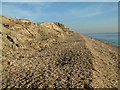

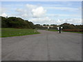
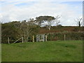
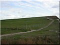
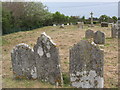
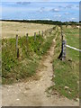
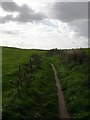
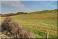
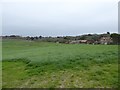
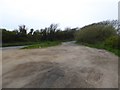
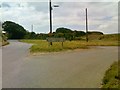
56 photos from this area
Area Information
Key information about the SO41 0XS including its size, population, and administrative classification.
- Area Type
- Postcode
- Area Size
- 7.9 hectares
- Population
- 1691
- Population Density
- 689 people/km²
House Prices in SO41 0XS
28
Properties
£791,667
Average Sold Price
£120,000
Lowest Price
£1,400,000
Highest Price
Showing 28 properties
| Address | Type | Beds | Baths | Last Sale Price | Last Sale Date | |
|---|---|---|---|---|---|---|
| Kew Haven House, Whately Road, Milford On Sea, SO41 0XS | Detached | 6 | 5 | £1,400,000 | Jan 2021 | |
| Beach House, Whately Road, Milford On Sea, SO41 0XS | Detached | 3 | - | £1,050,000 | Feb 2015 | |
| Solent View House, Whately Road, Milford On Sea, SO41 0XS | Detached | 5 | 4 | £1,200,000 | Jun 2008 | |
| Cliff Lodge, Whately Road, Milford On Sea, SO41 0XS | Bungalow | 3 | - | £500,000 | Apr 2007 | |
| Orchards End, Whately Road, Milford On Sea, SO41 0XS | Semi-detached | 5 | 5 | £480,000 | Aug 2006 | |
| 6, Whately Mews, Whately Road, Milford On Sea, SO41 0XS | house | 3 | - | £120,000 | Mar 2006 | |
| 14, Seabreeze, Scholars Retreat, Whately Road, Milford On Sea, SO41 0XS | Terraced | 4 | 4 | - | - | |
| 3, Scholars Retreat, Whately Road, Milford On Sea, SO41 0XS | Detached | 6 | 4 | - | - | |
| 15, Scholars Retreat, Whately Road, Milford On Sea, SO41 0XS | Detached | 4 | 4 | - | - | |
| 5, Whately Mews, Whately Road, Milford On Sea, SO41 0XS | Semi-detached | 3 | 1 | - | - |
Page 1 of 3
Energy Efficiency in SO41 0XS
Amenities
Schools
| Rank | School | Type | Entry gender | Ages |
|---|
Explore more schools in this area
Go to Schools tabDemographics
Household Size
Two person
most common
Accommodation Type
Houses
most common
Tenure
83
majority
Ethnic Group
White
most common
Religion
N/A
most common
Household Composition
N/A
most common
Age
47
median
Elderly (65+ years)
most common
Household Deprivation
N/A
with no deprivation
NS-SEC
47
in Lower managerial occupations
Explore more demographic insights in this area
Go to Demographics tabPlanning
Planning Constraints
- Flood RiskPremium
- Ramsar Wetland SitesPremium
- Area of Outstanding Natural BeautyPremium
- Protected Nature ReservePremium
- Protected WoodlandPremium